Geo-tagging of trees complete

LAHORE: Nespak has completed the geo-tagging of trees across a 22.5-kilometer stretch of Lahore Canal - the first large-scale digital mapping of urban green cover ever undertaken in the country.
The purpose is to make a data of each tree, its pic and make sure these trees are saved during construction of Yellow Line Electric Transit Project, which is planned for Lahore’s Canal Road, aiming to provide affordable and eco-friendly transportation. The project, spanning 24 kilometers from Thokar Niaz Beg to Harbanspura, is expected to be operational by June 2026 and serve around 130,000 passengers daily.
Nespak Managing Director Zargham Eshaq Khan Thursday stated that the effort is a part of the upcoming Yellow Line Electric Transit Project being launched by Punjab government. The initiative involved the precise identification of each tree using
GPS-enabled surveying equipment, with coordinates and tree-specific metadata integrated into a centralised GIS database. This structured dataset enables spatial analysis, supports condition monitoring, and provides a critical decision-making tool for authorities, urban foresters, and environmental planners.
Strategically located, the Lahore Canal green belt functions as one of provincial capital’s primary ecological corridors - mitigating air pollution, regulating microclimate, and enhancing urban biodiversity. Nespak’s intervention equipped this corridor with a robust digital inventory, facilitating data-backed management without disrupting the integrity of the ecosystem.
More than a technological deliverable, this initiative reflected Nespak’s expanding role in climate-conscious infrastructure development. The ability to digitise tree health baselines, plan plantations using geospatial intelligence, and identify encroachments or illegal removals sets a modern precedent for managing urban green assets with accountability.


-
 Bad Bunny Headlines Super Bowl With Hits, Dancers And Celebrity Guests
 -
 Insiders Weigh In On Kim Kardashian And Lewis Hamilton's Relationship
 -
 Prince William, Kate Middleton Private Time At Posh French Location Laid Bare
 -
 Stefon Diggs Family Explained: How Many Children The Patriots Star Has And With Whom
 -
 ‘Narcissist’ Andrew Still Feels ‘invincible’ After Exile
 -
 Shamed Andrew ‘mental State’ Under Scrutiny Amid Difficult Time
 -
 Bad Bunny's Super Bowl Halftime Show: What Time Will He Perform Tonight?
 -
 Where Is Super Bowl 2026 Taking Place? Everything To Know About The NFL Showdown
 -
 Chris Pratt Explains Why He And Katherine Schwarzenegger Did Premarital Counseling
 -
 Drake 'turns Down' Chance To Hit Back At Kendrick Lamar At Super Bowl
 -
 Sarah Ferguson Had A ‘psychosexual Network’ With Jeffrey Epstein
 -
 Miranda Kerr Shares The One Wellness Practice She Does With Her Kids
 -
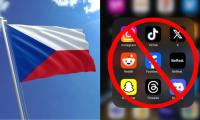 Czech Republic Supports Social Media Ban For Under-15
 -
 Khloe Kardashian Shares How She And Her Sisters Handle Money Between Themselves
 -
 Prince William Ready To End 'shielding' Of ‘disgraced’ Andrew Amid Epstein Scandal
 -
 Chris Hemsworth Hailed By Halle Berry For Sweet Gesture