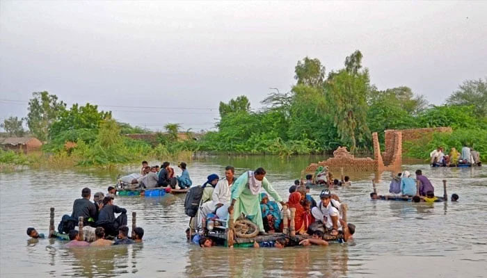
Flood telemetry master plan awaits green light
707 telemetry stations would be installed in two phases in the catchment areas of rivers in Punjab, Sindh, Khyber Pakhtunkhwa, Balochistan, Gilgit-Baltistan and AJK
ISLAMABAD: In a positive development, the government has developed the first ever National Master Plan for Flood Telemetry Network with the financial and technical assistance of the Asian Development Bank (ADP).
Under the plan, 707 telemetry stations would be installed in two phases in the catchment areas of rivers in Punjab, Sindh, Khyber Pakhtunkhwa, Balochistan, Gilgit-Baltistan and AJK. The project would soon be cleared by the Central Development Working Party (CDWP) and then the Executive Committee of National Economic Council (Ecnec).
The Federal Flood Commission and the Water and Power Development Authority (Wapda) played pivotal role in developing the project with the technical assistance of ADB, top sources in the Planning Commission, Wapda and Water Resources Ministry told The News.
Under Phase-1, 457 telemetry stations would be installed including 114 in Punjab, 30 in Sindh, 90 in KP, 149 in Balochistan, 48 in GB and 26 in AJK. Under phase-II, as many as 250 telemetry stations would be set up including 37 in Punjab, 16 in Sindh, 46 in KP, 58 in Balochistan, 36 in GB and 57 in AJK.
Phase-1 will be completed in five years costing Rs18.532 billion with foreign exchange component of US$36.286 million from the ADB. Pakistan’s major hydrologic units are the Indus River Basin, Kharan Desert Basin and Makran Coastal Basin. The main rivers originate from the Indus River Basin (IRB) of the northern mountains of Himalayas, Karakoram, Hindukush ranges and Kashmir.
Indus is the 12th largest river in the world and a trans-boundary river in Asia. During the last few decades, climate change has significantly influenced the flood flows making Pakistan one of the countries highly vulnerable to floods.
Rational prevention of natural disasters, such as floods and droughts, is strongly connected with a forecasting technology which cannot be achieved without hydro-meteorological observations.
Adequate and accurate hydro-meteorological data at fine time scale is very important and it is essential to improve the monitoring infrastructures by leveraging the modern technologies for remote control areas and data management for performing a range of hydrological studies.
The existence of a dense telemetry network of instruments is required to be able to model, predict and plan for catastrophic events which have obvious negative impacts on public health and socio-economic aspects in the country.
This project will also cater to the needs of the Flood Forecasting Division of Pakistan (FFD), Pakistan Meteorological Department (PMD), National Disaster Management Authority (NDMA) and Provincial Disaster Management Authority (PDMA) to issue early warnings, undertake quick rescue and relief activities at the district level about upcoming floods and will also complement the ability of various authorities to manage the water reservoirs effectively and carry out their functions as per the factual hydro-resources availability.
It will also help minimize panic in the society created by the sudden flood in hilly areas. So much so, it will also help design various hydropower projects. The project will help reduce human errors and improve the Upper Indus Basin hydro-meteorological data quality.
The operational costs will also be reduced by decreasing the manpower. Continuous measuring and reporting of data with high frequency will also be achieved through the project. Trained staff will be available for processing and management of data after completion of the project.
-
 Royal Family's Approach To Deal With Andrew Finally Revealed
 -
 Super Bowl Weekend Deals Blow To 'Melania' Documentary's Box Office
 -
 Meghan Markle Shares Glitzy Clips From Fifteen Percent Pledge Gala
 -
 Melissa Jon Hart Explains Rare Reason Behind Not Revisting Old Roles
 -
 Meghan Markle Eyeing On ‘Queen’ As Ultimate Goal
 -
 Japan Elects Takaichi As First Woman Prime Minister After Sweeping Vote
 -
 Kate Middleton Insists She Would Never Undermine Queen Camilla
 -
 King Charles 'terrified' Andrew's Scandal Will End His Reign
 -
 Winter Olympics 2026: Lindsey Vonn’s Olympic Comeback Ends In Devastating Downhill Crash
 -
 Adrien Brody Opens Up About His Football Fandom Amid '2026 Super Bowl'
 -
 Barbra Streisand's Obsession With Cloning Revealed
 -
 What Did Olivia Colman Tell Her Husband About Her Gender?
 -
 'We Were Deceived': Noam Chomsky's Wife Regrets Epstein Association
 -
 Patriots' WAGs Slam Cardi B Amid Plans For Super Bowl Party: She Is 'attention-seeker'
 -
 Martha Stewart On Surviving Rigorous Times Amid Upcoming Memoir Release
 -
 Prince Harry Seen As Crucial To Monarchy’s Future Amid Andrew, Fergie Scandal


