123-year old history of Pak-Afghan border
The Durand Line, which signifies the international border between Pakistan and Afghanistan, was established on November 12, 1893 after an accord was inked by a British diplomat Sir Mortimer Durand and the then Afghan ruler Abdur Rahman Khan.
The original 1893 Durand Line Agreement was written in English, with translated copies in local Dari language. The initial and primary demarcation, a joint Afghan-British survey and mapping effort, covered 800 miles and took place from 1894 to 1896.
Emir Abdur Rahman Khan was the Afghan ruler who had introduced the first passport of his country in 1880, meaning thereby that he was aware of the importance of documenting the movement of his country’s travellers.
In 1893, Afghanistan was considered by the British as an independent princely state, although the British controlled its foreign affairs and diplomatic relations.
While some publications have put the Pak-Afghan border’s length at 2,430-kilometres, there are historians who think this length is actually 2,250 kilometres.
The resulting agreement or treaty led to the creation of a new province called the North Western Frontier Province (NWFP), which is now known as Kyber Pakhtunkhwa, and had included the Federally Administered Tribal Regions (FATA), Multan, Dera Ghazi Khan, Mianwali and Bahawalpur areas at that time.
Annals of history reveal that the Durand Line had triggered a long-running controversy between the British Empire and successive Afghan governments, leading to the bombing of Kabul and Jalalabad by the British Royal Air Force in May 1919.
Afghan rulers reaffirmed in the 1919, 1921, and 1930 treaties to accept the Indo-Afghan boundary.
Inhabited by indigenous Pashtuns since at least 500 BC, the areas around the Durand Line were conquered by the Arab Muslims during the 7th century -- the period that marks the introduction of Islam to the Pashtun community.


-
 Justin Bieber Delivers Throwback-heavy Coachella Set With Surprise Appearances
 -
 Matcha May Help Reduce Sneezing During Allergy Season, Study Suggests
 -
 Cristiano Ronaldo Leads Al-Nassr To Set New Club Record With 14th Consecutive Win
 -
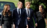 Royal Expert Warns Meghan Markle, Harry About 'notorious' Move
 -
 Eva Longoria Explains Why She Worked Secretly As A Corporate Employee For Years
 -
 Fred Armisen Unveils Unexpected Power Behind His Success
 -
 Meghan Markle's Hand-holding Moment Grabs Attention: Here's Why
 -
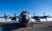 US Military Plane Damaged At Shannon Airport: Everything You Need To Know About The Man Arrest
 -
 Andrew Mountbatten-Windsor Finally Gets Royal Reunion: Inside Weekend With Brother
 -
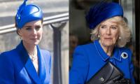 Kate Middleton, Queen Camilla Spark New Tension At Palace
 -
 Nine Inch Nails And Boys Noize Unveil First Full Set As Nine Inch Noize At Coachella
 -
 Tyson Fury Recalls Major Personal Loss Before 'fight Of A Lifetime' In 2024
 -
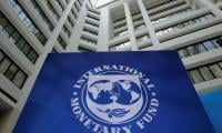 Middle East War Economic Shock Looms Over IMF
 -
 Eamonn Holmes ‘recovering’ After ‘terrifying’ Stroke
 -
 Obama Honors NASA's Artemis II Astronauts After Record-breaking Lunar Mission
 -
 UK PM Starmer Speaks Out After Peace Talks In Pakistan Hit Deadlock