Pakistan Navy hosts 8th ROPME Sea Area Hydrographic Commission meeting
Islamabad : The 8th ROPME Sea Area Hydrographic Commission (RSAHC) meeting is being hosted by Pakistan Navy at Islamabad from February 18 to 20, 2019, says a press release.
Vice Chief of Naval Staff, Vice Admiral Kaleem Shaukat inaugurated the opening session of the meeting as chief guest. Representatives of member states and International Hydrographic Organisation as well as Pakistan’s MoD and MoPDR attended the inaugural session. Rear Admiral (r) Mustafa Iptes, Director International Hydrographic Organisation was also present during the ceremony. The meeting is also being attended by leading industrial partners in maritime survey technologies.
During the 3-day meeting; matters related to nautical charting, capacity building and regional hydrographic cooperation would be discussed in detail. Each member would present their national report highlighting the progress made towards increasing the area surveyed and charted by modern and reliable means. This platform provides unique opportunity to establish a mechanism for supporting coastal states in capacity building.
RSAHC is one of the 15 geographically distributed regional bodies established by International Hydrographic Organisation to coordinate hydrographic activities around the globe and promote safety of shipping.
Presently, Pakistan is Chairman of RSAHC which includes North Arabian Sea, Gulf, Gulf of Oman, Strait of Hormuz, encompassing critical oil trade route. Other members of this Commission include Bahrain, Iran, Kuwait, Oman, Qatar and Saudi Arabia whereas France, UK and USA are associate members.
Pakistan has been a leading nation in RSAHC region since its establishment in year 2000. Acumen and quality work of Pakistan Hydrographic Office is acknowledged at international level and the charts produced by Pakistan are used extensively. Pakistan has acquired a State of Art new survey vessel that will be delivered by Sep 2019. The services of this ship will enhance our hydrographic capabilities which will also be available for regional surveying and capacity building.


-
 Michelle Obama Gets Candid About Spontaneous Decision At Piercings Tattoo
 -
 Bunnie Xo Shares Raw Confession After Year-long IVF Struggle
 -
 Brooks Nader Reveals Why She Quit Fillers After Years
 -
 Travis Kelce Plays Key Role In Taylor Swift's 'Opalite' Remix
 -
 How Jennifer Aniston's 57th Birthday Went With Boyfriend Jim Curtis
 -
 JoJo Siwa Shares Inspiring Words With Young Changemakers
 -
 James Van Der Beek Loved Ones Breaks Silence After Fundraiser Hits $2.2M
 -
 Disney’s $336m 'Snow White' Remake Ends With $170m Box Office Loss: Report
 -
 Travis Kelce's Mom Donna Kelce Breaks Silence On His Retirement Plans
 -
 Premiere Date Of 'Spider-Noir' Featuring Nicolas Cage Announced
 -
 Pedro Pascal's Sister Reveals His Reaction To Her 'The Beauty' Role
 -
 Kate Middleton Proves She's True 'children's Princess' With THIS Move
 -
 Paul Anka Reveals How He Raised Son Ethan Differently From His Daughters
 -
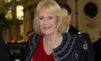 'A Very Special Visitor' Meets Queen Camilla At Clarence House
 -
 Jodie Turner Smith Shares One Strict Rule She Follows As A Mom
 -
 Hailey Bieber Reveals KEY To Balancing Motherhood With Career