WSSP prepares GIS-based map of drainage system

PESHAWAR: The Water and Sanitation Services Peshawar (WSSP) has prepared a comprehensive digital (GIS-based) map of drainage systems in the provincial metropolis.
The map covers all details, including the length, width, depth, starting and ending points, areas, union councils, and connections to natural water channels within the 42 union councils under WSSP’s jurisdiction. It also provides separate details of natural water channels entering and exiting WSSP’s boundaries.
The map was completed in one year, during which GPS devices were used to survey each area and drainage channel. Engineers and sub-engineers of WSSP collected the data, which was transferred to ArcGIS Software with the assistance of GIS experts from the Khyber Pakhtunkhwa Cities Improvement Project (KPCIP). The map serves as a foundational and comprehensive resource for planning and monitoring the drainage system.
The drains have been categorised into three categories-tertiary, secondary, and primary. The overall drainage system spans 1,862 kilometers, comprising 17,480 small and large drains within WSSP’s jurisdiction. These included 14 primary drains, 692 secondary drains, and 16,774 tertiary drains. Domestic and rain water flows into tertiary drains, which then feeds into secondary drains, eventually leading to primary drains and natural water channels.
The total length of tertiary drains is 1,419.97 kilometers, secondary drains 383.38 kilometers, and primary drains 58.85 kilometers. Additionally, WSSP manages one DEWATS system (Decentralized Wastewater Treatment System) and three pumping stations.
To appreciate the efforts of engineers and sub-engineers involved in preparing the map, a ceremony was held where WSSP Board of Directors Chairman Engineer Muhammad Uzair and Chief Executive Officer Yasir Ali Khan distributed certificates. General Manager PMER Syed Zamir-ul-Hassan and other officials were also present.
Engineer Muhammad Uzair and Yasir Ali Khan termed the map a landmark achievement and directed for digital map of the water supply system. Yasir Ali Khan also commended the staff for their contributions to this initiative.


-
 Meghan Markle Elated As ‘As Ever’ Proves To Be ‘double Edged Sword’
 -
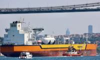 Gulf Shipping Crisis Deepens Amid Geopolitical Tensions: Can Global Powers Manage Oil Supply Shortfall?
 -
 Nicole Kidman Suffers From An Alarming Condition As She Experiences Emotional Fallout Amid The Marriage Failure
 -
 Tom Brady's Friends Warn Him About Alix Earle's Intentions Following The Romance Rumors
 -
 Fortnite Returns To Google Play Worldwide After Google, Epic Games Settle Dispute
 -
 Brad Pitt Steps In To Win The Fight Over Daughter Against Angelina Jolie
 -
 Teddi Mellencamp Shares Worrisome Update Amid Stage 4 Cancer Battle: 'I Thought I Had Flu'
 -
 US, UK Split On Crypto Collaboration: Can Bitcoin Help Secure A New Deal?
 -
 Harry Styles Gets Candid About Liam Payne's Death: 'I Really Struggled At First'
 -
 White House Officially Nominates 'Kevin Warsh' As Fed Chair To Senate: Here's Why
 -
 'Abbott Elementary' Gets Season 6 Renewal At ABC
 -
 Turkey To Ban Social Media For Under-15s Over Child Safety Concerns
 -
 Lucy Boynton Tapped To Star In 'Knight Of The Seven Kingdoms' Season 2
 -
 Sarah J. Maas To Drop Bombshell On 'Call Her Daddy' Podcast About ACOTAR 6?
 -
 Virginia Giuffre Continues To Haunt Buckingham Palace
 -
 Thomas Fugate: Trump's Pick For Terrorism Prevention Renews Concerns Amid War