Cyclone Biparjoy threat largely over, Sindh fishermen can return to their homes: official
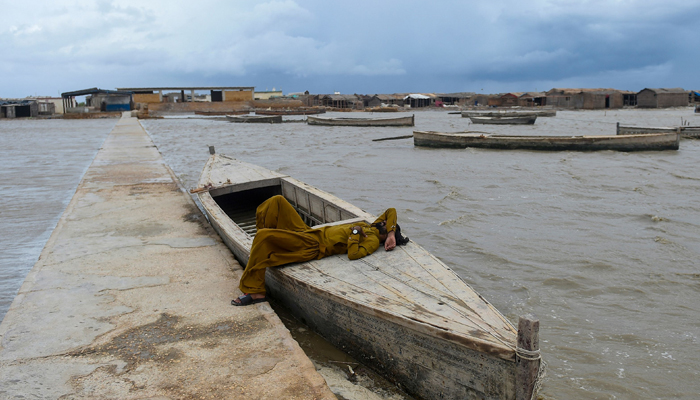
Fishermen in Badin will return to their villages from today, while rain is expected in district within next 24 hours.
As cyclone Biparjoy makes landfall along the Indian Gujarat coast (Jakhau port) and Pakistan-India border, sparing Sindh's coastline from major damage, the fishermen — who were shifted to safer places — can now return to their homes from today, District Badin's Deputy Commissioner (DC) Agha Shahnawaz said Friday.
More than 180,000 people were evacuated in India and Pakistan in the last few days as authorities braced for the cyclone, named Biparjoy, to hit coasts in both countries.
Biparjoy, which means 'disaster' or 'calamity' in the Bengali language, made landfall near Jakhau, a port in Gujarat that is close to the border with Pakistan, weather officials said.
Roofs were blown off houses and trees, and electric poles were uprooted in several parts of the Indian state due to squally winds. No casualties were reported.
According to Pakistan's National Disaster Management Authority (NDMA), the very severe cyclonic storm (VSCS) cyclone Biparjoy will further weaken today.
"It is expected to move north-eastward and weaken into a cyclonic storm by morning 16 June and further weaken into a depression by evening 16 June," the NDMA said.
Since the cyclone, as per DC Badin, has largely subsided, the fishermen will return to their villages from today. Meanwhile, rainfall in the district is expected in the next 24 hours.
On the other hand, Sujawal Deputy Commissioner Imtiaz Abro said light rain and winds continued in the district and its surroundings since night. “The threat of a storm has come to an end,” he said.
Residents of areas at threat, who were evacuated and residing in relief camps, will begin returning to their homes from tomorrow, as per the DC.
Abro added that the damage due to strong winds and rain at night is being assessed.
The NDMA said that the cyclone is currently at latitude 23.4°N and longitude 68.5°E and remains at a distance of about 255 kilometres from Karachi, 165 kilometres from Thatta and 125 kilometres from Keti Bandar.
The maximum sustained surface winds, as per the disaster management authority, are between 100 to 120 kilometres per hour with gusts moving at 130 kilometres per hour around the system centre. "Expected maximum wave height in Northeast Arabian sea is around 10 to 15 feet," it added.
Likely Impacts:
- Widespread rain and thunderstorm with heavy/very heavy falls accompanied with squally winds of 80 to 100 kilometres per hour are likely in Thatta, Sujawal, Badin, Tharparker, Mirpurkhas and Umerkot districts till June 17.
- Storm surge of 6 to 8 feet is expected at the land falling point (Keti Bandar and surrounding areas), which can inundate the low-lying areas.
- Squally winds may cause damage to lose structures in Thatta, Sujawal, Badin, Tharparker and Umerkot districts.
- Dust/thunderstorm and rain with a few heavy falls and accompanied with gusty winds of 30 to 50 kilometres per hour are likely in Karachi, Hyderabad, Tando Muhammad Khan, Tando Allayar, Shaheed Benazirabad and Sanghar districts tonight and tomorrow.
- Sea conditions along the Sindh-Makran coast are likely to be rough / very rough (2 to 2.5 meters).
'Difficult to predict track of Arabian Sea cyclones'
Weather expert Jawad Memon told Geo News that the cyclone's effects were limited to Sindh's coastal belt, and the rains in other parts of the country were due to western disturbance.
"...the system causing rains in other parts of Pakistan will intensify due to western disturbance and pre-monsoon system. This will lead to rains in Khyber Pakhtunkhwa, Punjab, and isolated areas in Balochistan."
He clarified that pre-monsoon activities begin in July, and according to forecasts, it has been delayed for some days due to the cyclonic system in the Arabian Sea.
"Overall, this is normal [...] it is manageable." He noted that the cyclone would downgrade into a depression within 24 hours.
The weather expert noted that it is tough to predict the pattern of Arabian Sea cyclones, and their path is always confirmed at the last moment.
"Contrastingly, the cyclone patterns in the Bay of Bengal are predictable. Over here, the environment is hostile which is why we can't predict the cyclones' pattern."
'Thank God'
Climate Change Minister Senator Sherry Rehman told Geo News that the authorities would hold a meeting in the afternoon to discuss how to send the affectees back to their homes.
The Sindh government had evacuated as many as 67,367 people from the three vulnerable districts — Thatta, Sujawal, and Badin — and 39 relief camps were set up to house them.
"Thank God; we are safe from the destruction of the cyclone. But it might take us some time to send people back to Sujawal," the federal minister said, noting that their livelihoods had been significantly impacted.
On criticism about the government's response, the minister said the population has grown to a huge extent, and the authorities cannot reach everywhere.
She said 8,000-9,000 livestock were also transferred to safe places.
The federal minister said Biparjoy had lived longer than any other cyclone.
-
 Punjab by-polls: Notices served on minister, SAPM for ‘violating’ election code of conduct
 -
 27th Amendment empowers FCC to hear all constitutional cases: minister
 -
 JF-17 attracts strong attention at Dubai Airshow as friendly country inks procurement MoU
 -
 US lawmakers laud Punjab govt's initiative to modernise brick-kiln
 -
 Security forces gun down 30 terrorists in multiple IBOs in KP: ISPR
 -
 MQM-P calls for new province in Sindh
 -
 US report validates Pakistan military edge over India: PM
 -
 Banned TTP poses serious threat to Pakistan security: UNSC panel


