China launches two satellites for Pakistan
Pakistan Remote Sensing Satellite-1 (PRSS-1) and Pakistan Technology Evaluation Satellite-1A (PakTES-1A) -- were launched through Long March-2C rocket, at 0857 hours (PST), from a satellite centre located in Northwest China.
JIUQUAN: China launched two satellites for Pakistan on a Long March-2C rocket from the Jiuquan Satellite Launch Center in northwest China at 11:56 a.m. Monday.
The PRSS-1 is China’s first optical remote sensing satellite sold to Pakistan and the 17th satellite developed by the China Academy of Space Technology (CAST) for an overseas buyer.
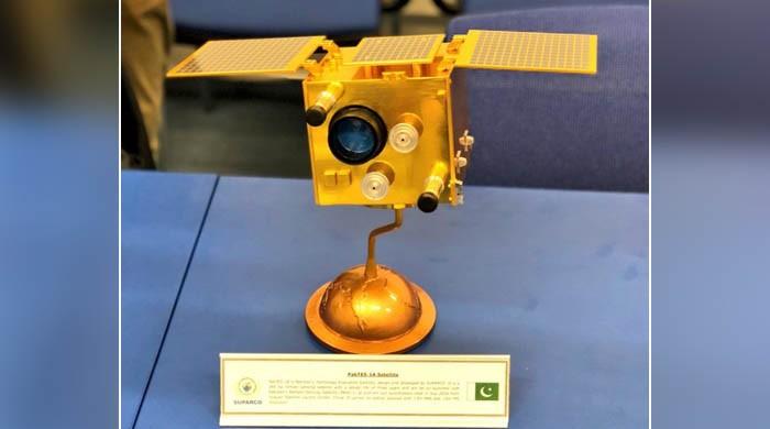
A scientific experiment satellite, PakTES-1A, developed by Pakistan, was sent into orbit via the same rocket.
This is another space cooperation between China and Pakistan since the launch of PAKSAT-1R, a communication satellite, in August 2011.
The PRSS-1 will be used for land and resources surveying, monitoring of natural disasters, agriculture research, urban construction and providing remote sensing information for the Belt and Road region.
Monday’s launch is the 279th mission of the Long March rocket series.
The Foreign Office confirmed that the satellites -- Pakistan Remote Sensing Satellite-1 (PRSS-1) and Pakistan Technology Evaluation Satellite-1A (PakTES-1A) -- were launched through Long March-2C rocket, at 0857 hours (PST), from a satellite centre located in Northwest China.
Terming the launch a “great achievement” for the country, Foreign Office Spokesman, Dr Muhammad Faisal said the successful implementation of PRSS-1 and PakTES-1A projects had further strengthened the space cooperation with China for future collaboration.
The Spokesman said the 1,200 kg PRSS-1 and the 285 kg PakTES-1A satellites would operate at an altitude of 640 km and 610 km, respectively, and would also enable the country in agriculture classification and assessment, urban and rural planning and water resource management.
He said the satellites would help Pakistan end its reliance on commercial satellites for environmental monitoring particularly to address the challenges of floods, drought and water shortage.
The satellites will also help assess the situation of forestation, rainfall and storage of rain water.
The PakTES-1A, indigenously designed and developed by SUPARCO’s engineers, is equipped with an optical payload, Global Positioning System (GPS) and Geographical Information System (GIS).
It has a design life of three years.


-
 Shanghai Fusion ‘Artificial Sun’ achieves groundbreaking results with plasma control record
 -
 Polar vortex ‘exceptional’ disruption: Rare shift signals extreme February winter
 -
 Netherlands repatriates 3500-year-old Egyptian sculpture looted during Arab Spring
 -
 Archaeologists recreate 3,500-year-old Egyptian perfumes for modern museums
 -
 Smartphones in orbit? NASA’s Crew-12 and Artemis II missions to use latest mobile tech
 -
 Rare deep-sea discovery: ‘School bus-size’ phantom jellyfish spotted in Argentina
 -
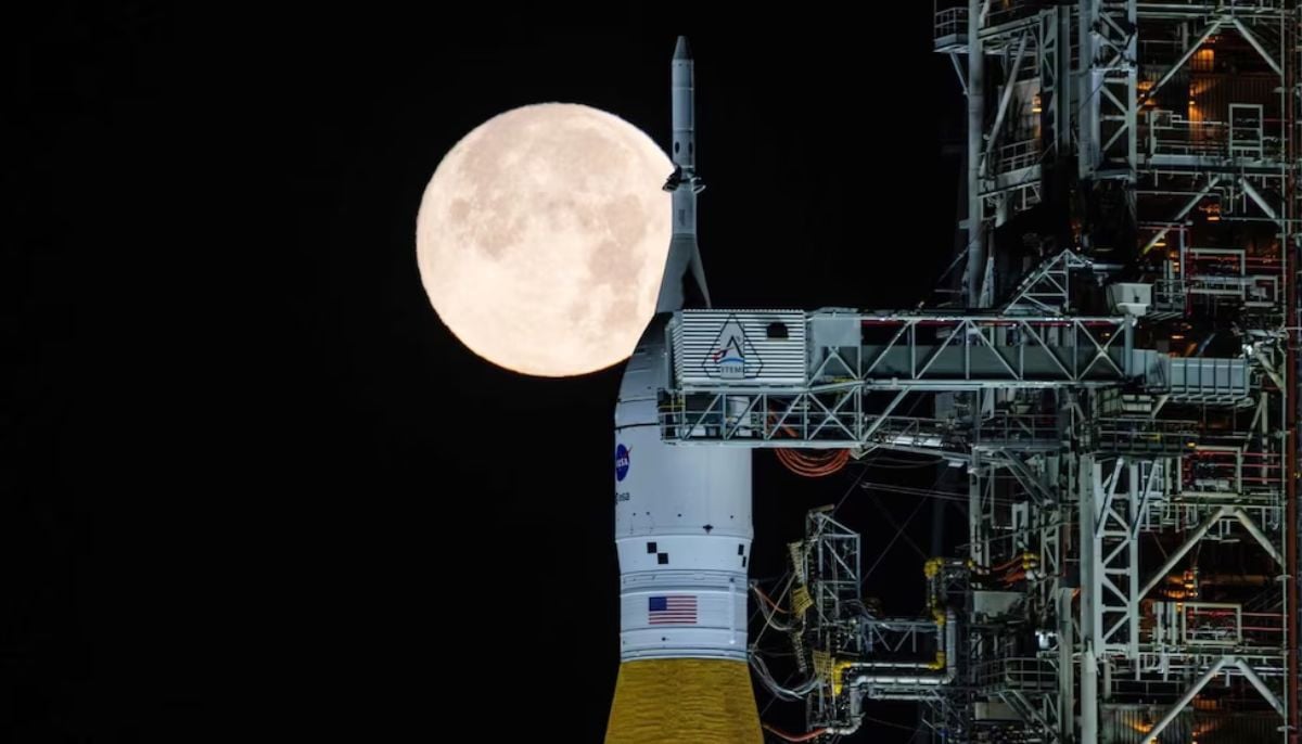 NASA eyes March moon mission launch following test run setbacks
 -
 February offers 8 must-see sky events including rare eclipse and planet parade