Workshop at University of Haripur: GIS potential in agriculture, natural resource management underlined
HARIPUR: The Geographical Information System GIS has a great potential in agriculture and natural resource management together with career development of researchers opting to use the modern technique in their project drawing and design.
This was the main focus of the speeches that the scientists gave during the inaugural session of two days international workshop on “Use of GIS Technology and Stable Isotopes for sustainable development in Agriculture and environment”. The Departments of Soil and Climate Sciences University of Haripur had organized the event in collaboration with Pakistan Science Foundation and Chemistry Department of varsity here on Thursday.
The scientists, researchers, academia and students from different parts of the country were in attendance on this occasion. The speakers said that the GIS was a computer based system for collecting, checking, integrating and analyzing information related to the surface of the earth. Highlighting the major applications of GIS, the speakers said that the GIS techniques were being used globally in natural resource and environmental protection. They said socio-economic development, land & water management, civic supplies and crime detection and the developing agro-based economy of Pakistan ought to benefit from the modern techniques for the desired results of prosperity.
They said that GIS has an important role to play in farm management, pest/disease tracking, crop monitoring, yield production and soil analysis. While in environmental sciences it has a very vital role for analysis and formulating the quick mitigation plan for high risk environments, they said. The speakers said it could serve as the ultimate communication of environmental information to the public and policy makers for wildland analysis, hazards mitigation & future planning, air pollution and control, disaster management, oil spills and remedial actions and coal mine fires. They said the GIS could also be used for business purposes, geology, archaeology and architecture purposes and its applications have multidimensional benefits for the researchers, policymakers and the public at large. Dr Arshad Ashraf principal scientist Climate Change, Alternative Energy and Water Resource Institute Islamabad, Dr Sarfraz Ahmed, Dr Imran Shahzad Department of Metrology COMSATS, Dr Rasheed Ahmed, Prof Dr Anwarul Hasan, VC UoH, Dr Ali Raza Gurmani, Chairman, Department of Soil & Climate Sciences, were prominent among those who spoke to the participants on this occasion.


-
 ICE Agents 'fake Car Trouble' To Arrest Minnesota Man, Family Says
 -
 Camila Mendes Reveals How She Prepared For Her Role In 'Idiotka'
 -
 China Confirms Visa-free Travel For UK, Canada Nationals
 -
 Inside Sarah Ferguson, Andrew Windsor's Emotional Collapse After Epstein Fallout
 -
 Bad Bunny's Star Power Explodes Tourism Searches For His Hometown
 -
 Jennifer Aniston Gives Peek Into Love Life With Cryptic Snap Of Jim Curtis
 -
 Prince Harry Turns Diana Into Content: ‘It Would Have Appalled Her To Be Repackaged For Profit’
 -
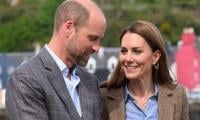
 Prince William's Love For His Three Children Revealed During Family Crisis
 -
 Murder Suspect Kills Himself After Woman Found Dead In Missouri
 -
 Sarah Ferguson's Plea To Jeffrey Epstein Exposed In New Files
 -
 Prince William Prepares For War Against Prince Harry: Nothing Is Off The Table Not Legal Ways Or His Influence
 -
 'How To Get Away With Murder' Star Karla Souza Is Still Friends With THIS Costar
 -
 Pal Reveals Prince William’s ‘disorienting’ Turmoil Over Kate’s Cancer: ‘You Saw In His Eyes & The Way He Held Himself’
 -
 Poll Reveals Majority Of Americans' Views On Bad Bunny
 -
 Wiz Khalifa Thanks Aimee Aguilar For 'supporting Though Worst' After Dad's Death
 -
 Man Convicted After DNA Links Him To 20-year-old Rape Case