
Satellite images show where water is disappearing globally: Key locations explained
The global freshwater crisis is significantly worsening due to rising climate and intense land pressure
According to a 2025 World Bank report, the world loses an estimated 324 trillion litres of freshwater each year-enough to meet the needs of 280 million people.
While this continued water scarcity known as “continental drying” is triggered by worsening droughts and unsustainable land practices, the UN has marked today a crucial day to raise public awareness about halting desertification and restoring degraded land.
Following are the significant examples of shrinking rivers, lakes and dams across the world:
South America
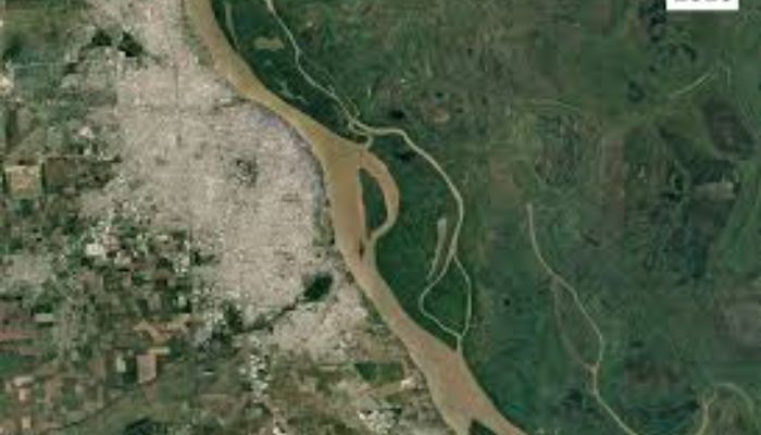
Between 1990 and 2026, multi-year droughts have caused water levels in South America’s second-largest river (4,900km) to plummet at the port of Rosario.
This drastic shrinkage has caused logistical disruptions, lowered hydroelectric output at the Itaipu Dam, and exposed expansive riverbed flats and new islands. Notably, Bolivia’s satellite imagery from 1984 and 2020 demonstrates how Lake Poopo which once covered 1,000 square kilometers has completely disappeared.
Satellite imagery from 1984 to 2020 demonstrates that extreme climate sensitivity of Lake Ngami, and severe droughts caused it to nearly dry up into a cracked basin-along with destroying fishing and livestock pastures before it entered a partial recovery.
Additionally, intense sandstorms and rainfall deficits have affected farmland resulting in weakening subsistence agriculture.
Middle East & Central Asia
Lake Urmia located in northwestern Iran was once called the Middle East’s largest saltwater lake-spaning nearly 6,000 square kilometers in the 1990s-but has reportedly shrunk to less than 10 percent of its former size.
North America
Lake Mead is the largest reservoir in the United States by capacity. A comparison of 1984 and 2020 satellite imagery show the reservoir’s significant decline as the dry spell persists, rising temperatures and heavy water demand have exposed sweeping beaches, threatening a crucial water supply for millions living in the US Southwest and Mexico.




-
 Trump vows to lift Turkey sanctions, considers F-35 deal at NATO summit
 -
 Reform’s Nigel Farage resigns as MP amid funding row, vows to contest Clacton by-election
 -
 French court allows Marine Le Pen for Presidential run, lifts election ban
 -
 Saudi Arabia launches all-in-one ‘Package Visa’ to simplify travel
 -
 EU to extend controversial 'Chat Control' rules to scan messages, sparking fresh privacy debate
 -
 WHO warns Europe faces more deadly weeks as new heatwave intensifies
 -
 Trump expected to back potential sale of F-35 jet sale to Turkey
 -
 Iran targets commercial ships with missiles in the Strait of Hormuz: report