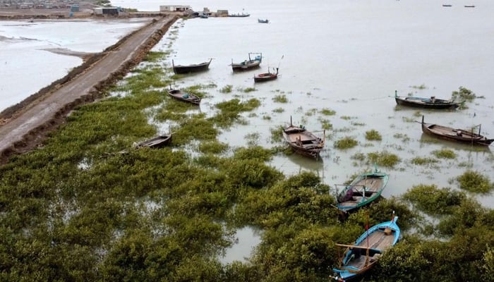
Keti Bandar braces for Biparjoy landfall today
Sherry Rehman says Thatta, Sujawal, Badin, and Tharparkar districts will be hit the hardest
ISLAMABAD/ KARACHI: Climate Change Minister Sherry Rehman has said that cyclone Biparjoy, which has slightly moved away from Karachi, will hit Sindh’s Keti Bandar today (Thursday). While there was no direct threat to the megacity, NDMA Chairman Lt-Gen Inam Haider Malik said there was still a risk of urban flooding in Karachi.
Addressing a press conference in Islamabad on Wednesday, Climate Change Minister Sherry Rehman said as many as 66,000 people had been evacuated to safer places from Sindh’s coastal areas thus far. The federal minister also requested the people to cooperate with authorities and added that all rescue agencies were prepared for relief operations. “The true form of the cyclone will be known tomorrow [Thursday],” she said.
The minister said Thatta, Sujawal, Badin and Tharparker districts will be hit hardest by the cyclone, adding that Biparjoy was moving away from Karachi. She said that the cyclone had forced the authorities to suspend small aircraft operations in the country. Commercial flight operations would be suspended as the cyclone drew closer to the country.
The minister said the cyclone’s distance from Karachi was increasing as it veered towards the east but at the same time warned that it was coming closer to the coastal areas. “It seems Biparjoy is going northeast and it seems it will take a hard right even further to the east, which means it will go past the megacity of Karachi,” she said. NDMA Chairman Lt-Gen Inam Haider Malik said there was still a risk of urban flooding in Karachi but Met officials ruled out any direct threat to the city.
PMD Sindh Chief Meteorologist Sardar Sarfaraz said, “There is no dangerous situation in Karachi, the cyclone will exit from the city’s south.” The chief meteorologist said the city could receive heavy rainfall on Thursday and Friday.
Earlier on Wednesday, the climate change minister told the National Assembly that the government was ensuring effective monitoring of tropical cyclone Biparjoy, which was moving steadily towards the Pakistan and Indian coastlines. “All tracking institutions of Pakistan, including PMD and Suparco, are working round the clock with international satellites, especially Thailand, as it is inching towards Pakistan and India’s coastline with intensity,” she said. Biparjoy’s intense landfall is expected to hit Keti Bandar.
“Currently, it is moving at around 120-140km/h. Its centre has much speed and density,” she said, adding that the Sindh government had issued an advisory timely, following which voluntary and vulnerable areas were being evacuated as per safety measures.
The evacuation was almost complete, she said. “It’s [cyclone’s] focus is in Sindh; however, parts of Balochistan will also be affected by gusty winds and rains,” the senator said, highlighting that Badin, Thatta, Sujawal and Malir [Karachi] would face the brunt of the storm.
Sherry said the Sindh government has set up around 75 relief camps and evacuated more than 62,000 people to safer places where clean drinking water, food and medical facilities were available.
The minister urged the people of areas where the cyclone was likely to hit to cooperate with the civil administration and follow the “mandatory evacuation” directive.
All necessary arrangements were being made to keep the losses at their lowest, along with ensuring supply of all essential commodities, including electricity, gas and petroleum products.
She asked the residents to remove solar panels as per safety measures and move to safer places voluntarily, adding the Sindh government had removed billboards from several places. The minister advised the public not to panic but take precautionary measures and cooperate with the departments working for their well-being.
Meanwhile, Karachi DHA took to Twitter to warn residents that high tides pose an “imminent threat” to the port city; it also advised residents of Abdul Sattar Edhi Avenues and Do Darya to evacuate the areas.
“Rising high tides pose an imminent threat to Karachi. Residents residing in Abdul Sattar Edhi Avenues and Do Darya are urged to evacuate and follow DHA Karachi’s instructions,” the housing authority tweeted. In a related development, authorities in Sindh moved 67,367 people from the coastal districts to temporary shelters, officials said. “Around 67,367 people have been moved from Thatta, Badin and Sujawal districts as precautionary measures and shifted to temporary shelters. Biparjoy is now 300 kms south-southwest Thatta and 240 kms south-southwest of Keti Bandar,” Sindh Chief Minister Syed Murad Ali Shah said.
The chief minister maintained that thousands of people were asked to shift to the relief camps while several thousand people left their homes voluntarily as military troops, Rangers personnel and officials from the district administration helped them to shift to relief camps in Keti Bandar, Ghora Bari, Shaheed Fazil Rahu, Badin, Jati, Shah Bandar and other coastal areas of southeast Sindh. Giving updates on the storm, Pakistan Meteorological Department (PMD) officials said very heavy rains with some extremely heavy falls, accompanied by squally winds of 80-120 km/hour, were expected in Thatta, Sujawal, Badin, Tharparkar, Mirpurkhas and Umerkot districts in the coming four days under the influence of Extremely Severe Cyclonic Storm (ESCS) Biparjoy, which is likely to hit between Keti Bandar and Indian Gujarat coasts.
“The storm has moved nearly northeastward during the last 6 hours and is most likely to hit the coastal belt of Pakistan between Keti Bandar and Indian Gujarat coasts by June 15 afternoon as Very Severe Cyclonic Storm,” the PMD said in its latest tropical cyclone alert on Wednesday night. “The favourable environmental conditions (sea surface temperature of 29-31C, low vertical wind shear and upper-level divergence) are supporting the system to maintain its severity. Existing models and climatic conditions indicate that the storm can make its landfall between Keti Bandar Sindh and Rann of Kutch/ Indian Gujarat coasts on the afternoon or evening of June 15,” Dr Sardar Sarfraz, Chief Meteorological Officer, Sindh, told The News. He said the storm surge of 3-3.5 meters (8-12 feet) was expected at the land falling point (Keti Bandar and around), which can inundate the low-lying settlements.
Sarfraz maintained that VSCS Biparjoy over the east-central Arabian Sea was maintaining its intensity, moved further north-northwestward during the past 6 hours and now lies near latitude of 22.4°N & longitude 66.8°E at a distance of about 275 kms south of Karachi and 285 kms south south-west of Thatta and 200 kms south southwest of Keti Bandar. “Maximum sustained surface winds are 150-160 kms/hour, gusting to 180 km/hour around the system center and sea conditions being phenomenal around the system centre with maximum wave height 30 feet.”
The PMD official maintained that with its probable north-northeast track, rain-thunderstorm with some very heavy falls and squally winds (80-100 Km/hour) are expected in southern/southeastern Sindh (Thatta, Sujawal, Badin, Tharparkar and Mirpurkhas districts) till 17 June evening. “Dust/thunderstorm-rain with few heavy falls & accompanied with squally winds of 60-80 Km/hour likely in Karachi, Hyderabad, Tando Muhammad Khan, Tando Allayar, Mirpurkhas districts from 14-16 June,” he said, adding that squally (high intensity) winds may cause damage to loose and vulnerable structures (Kutcha houses). Storm surge of 3-5 meters (8-12 feet) can be possible, he said.
The PMD official maintained that dust/thunderstorm-rain with isolated heavy falls is likely in Hub, Lasbella districts of Balochistan during 14-16 June, adding that squally (high intensity) winds may cause damage to loose and vulnerable structures (Kutcha houses) including solar panels, etc. Sea conditions along the Sindh coast may get very rough to high (2-2.5 meter) and rough to very rough (2 meter) along Balochistan coast (Sonmiani, Hub, Kund Malir, Ormara and surroundings), he said adding that fishermen are advised not to venture in the open sea till the system is over by June 17.


-
 Robbie Williams Confirms ‘exciting’ Performance At FIFA World Cup Final
 -
 Taylor Swift, Travis Kelce's ‘top-secret’ Wedding Location Still A Mystery?
 -
 Matt Damon Talks About Filming ‘The Odyssey’ With No ‘special Treatment’
 -
 Meghan Markle Gives Prince Harry Key Assurance Before Meeting King Charles In UK
 -
 It's Scary': US Congressman Reacts To Anthropic's Powerful AI Model
 -
 King Charles ‘worried’ For Prince William As Heir Doesn’t Have Temperament To Be King
 -
 France Records Around 1,000 Excess Deaths During Deadly Heatwave
 -
 Kris Jenner Crowns Khloe Kardashian 'most Amazing Mother' In Birthday Tribute
 -
 David Beckham Melts Hearts With His Unseen Baby Snaps As Celebrated Mom Sandra
 -
 Which Countries Will Ban Grand Theft Auto VI At Launch?
 -
 Prince Harry’s ‘emotional Safe Haven’ In UK Revealed
 -
 North West Debuts Daring New Facial Piercings At Paris Fashion Week
 -
 Why Tech Firms Are Blaming AI For The Massive Surge In Device And Console Prices
 -
 Prince William’s Secret To A Successful Marriage With Kate Middleton Comes To Light
 -
 Google Gemini AI Capacity Shortage Delays Meta's AI Projects: Report
 -
 Holly Madison Reveals Why She Underwent Plastic Surgery After Pregnancies