Snow storm warning in Ontario’s weather forecast through Tuesday
Environment Canada has issued a significant weather outlook covering Saturday through Tuesday, warning that several regions could see heavy snow
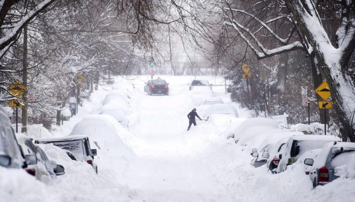
Snow and cold temperatures are expected to to dominate in the weather forecast in southern Ontario over the coming days, according to Environment Canada.
The federal weather agency has issued a significant weather outlook covering Saturday through Tuesday, warning that several regions could see heavy snow, strong winds, and extreme cold.
Parts of the Bruce Peninsula, Manitoulin Island, and areas east of Georgian Bay could receive lake-effect snow or snow squalls, with local snowfall totals of 10 to 20 centimetres on Saturday.
Forecasters say blowing snow may also develop, leading to reduced visibility and difficult travel conditions.
“Lake-effect snow or snow squalls will continue off Lake Huron and Georgian Bay on Sunday with bands meandering from south to north through the day. Local snowfall amounts of 5 to 15 cm accompanied by local blowing snow are expected,” Environment Canada said.
“Lake enhanced snow is expected to develop Sunday evening off Lake Superior with local snowfall amounts of 5 to 15 cm possible before midnight. Local blowing snow is also possible.”
“Lake effect snow or snow squalls will continue, shifting further south from the previous day, bringing local snowfall amounts of 10 to 15 cm,” the agency said.
“Strong wind gusts near 50 to 70 km/h will also bring local blowing snow.”
“The windchill values are expected to moderate Tuesday night or early Wednesday morning,” Environment Canada said.


-
 US Army Chief Randy George asked to step down by Pete Hegseth in major shakeup
 -
 Pam Bondi, dubbed Trump's Ghislaine Maxwell, gets fired
 -
 Macron slams Trump: ‘Neither elegant nor up to standard’ over mockery
 -
 Storm Dave: Everything you need to know to stay safe this Easter weekend
 -
 Brazil approves law giving separated couples joint custody of pets
 -
 'Poisoned' Mount Everest climbers expose guides' million-dollar fraud scheme
 -
 NASA Artemis II historic rocket launch: Spacecraft successfully enters Earth orbit
 -
 Vanessa Trump remains loyal to Tiger Woods after DUI arrest: Report
-
 Pink moon 2026: when to see April’s full moon and why it won’t look pink in the sky
 -
Reese's Peanut Butter Cups to return to classic chocolate recipe following public backlash
-
TDSB vice principal jobs cut as board removes 40 roles amid funding loss, enrolment decline
-
Earthquakes hit Indonesia off Ternate, triggering tsunami warning that is now lifted


