Pakistani technicians get surveying, mapping training in China
Pakistan requested assistance from the Chinese government to establish a Next-Generation Geodetic Datum of Pakistan way back in 2011

ISLAMABAD: The second technical training for establishing new generation national geodetic datum of Pakistan has been completed in China.
The diplomatic sources told The News that some 12 technicians from Pakistan participated in the course to improve and update their knowledge of surveying and mapping technology. Pakistan requested assistance from the Chinese government to establish a Next-Generation Geodetic Datum of Pakistan way back in 2011. The geographic information system mapping and surveying project is expected to encourage research and innovation in the fields of economy and society.
Its linkages would promote cooperation between science and technology, public institutions and government agencies. In May 2017, governments of Pakistan and China signed letters of exchange and the Chinese government pledged financial support for the project.
According to the organizer, geodetic datum provides an essential spatial reference framework for mapping and construction activities along China-Pakistan Economic Corridor (CPEC), ensuring accuracy and alignment with project objectives. This training course has equipped a team of professionals with expertise in mapping technology, leading to the strengthening of bilateral relations and propelling both countries to a more advanced stage of innovative development.


-
 King Charles Speaks Out Over Andrew's Scandal: 'Stand Ready To Help Police'
 -
 Dax Shepard Recalls Horrifying Accident That Almost Killed Him
 -
 Logan Paul's Bodyguard Hits Fan On Super Bowl Day
 -
 Epstein Files: Anne Hathaway Mentioned As Highly Desired Guest For Bill Gates?
 -
 Prince Harry Under A Lot Of Stress As Meghan Markle Makes Bizarre Demands
 -
 Princess Beatrice, Eugenie's Subtle Break From Disgraced Parents Exposed
 -
 Baby Left In Running Bathtub Dies After Father ‘forgets’ Him
 -
 King Charles Takes A Major Step To Keep Horrified Prince William Out Of The Loop On Andrew: Insider
 -
 Taylor Swift Set To Make Biggest Cut From Her Wedding Guest: Blake Lively Or Ryan Reynolds
 -
 Prince William Meets Saudi Crown Prince Mohammed Bin Salman
 -
 Brooklyn Beckham Brutally Cuts Off Inner Circle Amid Feud With David, Victoria
 -
 Kaley Cuoco Reveals Why Fiance Tom Pelphrey Sleeps In Seperate Room
 -
 Ghislaine Maxwell Will Not Answer Congress Questions On Epstein
 -
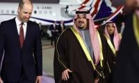 Kensington Palace Announces Prince William's Arrival In Saudi Arabia
 -
 ‘Andrew Crisis Follows King Charles Everywhere Now’
 -
 Jennifer Aniston Already Decided Her Wedding Dress?