The talbiya of Allah’s Apostle (S.A.W) was, “I respond to Your call O Allah, I respond to Your call, and I am obedient to Your orders...

BITS ‘N’ PIECES
Narrated by Abdullah bin Umar (R.A):
The talbiya of Allah’s Apostle (S.A.W) was, “I respond to Your call O Allah, I respond to Your call, and I am obedient to Your orders, You have no partner, I respond to Your call, All the praises and blessings are for You, All the sovereignty is for You, And You have no partners.”
Sahih Bukhari, Volume 2, Book 26, Number 621
People in ancient times used constellations like road signs in the sky.
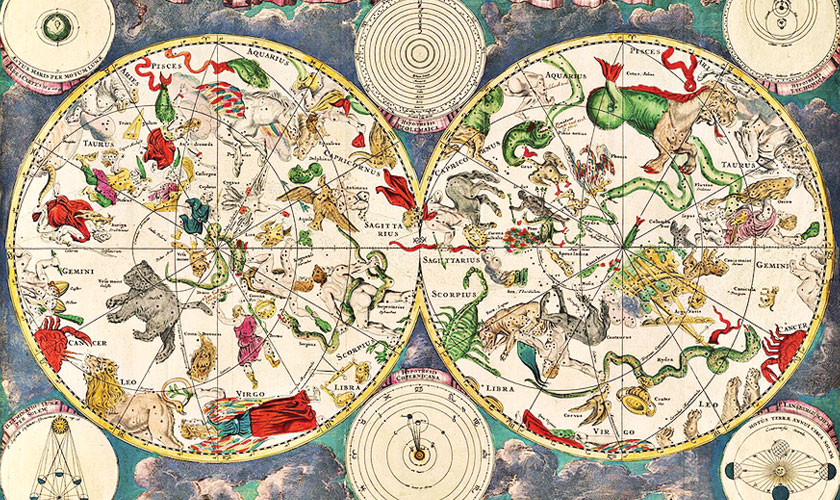
Before the advent of modern navigation tools like GPS and digital maps, people in ancient times relied heavily on the stars to find their way. For centuries, the night sky served as a natural compass, guiding sailors across vast oceans, helping desert travellers chart their routes, and even assisting early farmers in determining the right time to plant and harvest crops. The ability to navigate by the stars was not just a skill, but a necessity, especially for those venturing far from familiar territories.
One of the most widely used stars for navigation was Polaris, commonly known as the North Star. Located almost directly above the North Pole, Polaris appears fixed in the night sky while other stars seem to revolve around it. This unique position made it an essential reference point for travellers in the Northern Hemisphere. By locating Polaris, navigators could determine which direction was north and align their path accordingly. The height of Polaris above the horizon also helped them estimate their latitude, offering a rough idea of how far north or south they were.
Ancient seafarers, such as the Phoenicians and Polynesians, were particularly skilled in celestial navigation. The Polynesians, for instance, memorised complex star maps and patterns, using them to cross thousands of kilometres of open ocean with remarkable accuracy. They observed the rising and setting points of specific stars and constellations to maintain direction. These star paths, passed down orally through generations, were an integral part of their culture and knowledge system.
In Europe, during the Age of Exploration, navigators began using tools like the astrolabe and later the sextant to measure the angle between stars and the horizon. These measurements helped them calculate their position at sea, improving long-distance navigation. The development of detailed star charts also allowed sailors to better understand the movement of celestial bodies, enhancing their ability to travel safely across the globe.
Even on land, stars guided nomads and traders. In deserts, where landmarks were scarce, constellations acted like road signs in the sky. Groups like the Bedouins used star positions to guide their caravans at night, avoiding the harsh heat of the day and navigating safely under the canopy of stars.
The stars have long served as a silent, dependable guide for humankind. Through careful observation and the passing down of knowledge, ancient people learned to read the sky as a map, showcasing both their ingenuity and deep connection with the natural world.