Pakistan to launch Remote Sensing Satellite on July 31
Satellite's role will be vital in predicting and mitigating impacts of floods, earthquakes
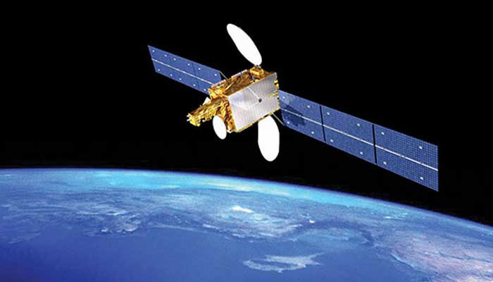
The Pakistan Space and Upper Atmosphere Research Commission (Suparco) is set to launch the country’s Remote Sensing Satellite (PRSS) on July 31 from China’s Xichang Satellite Launch Centre (XSLC).
This landmark mission marks a significant stride in Pakistan’s pursuit of space technology, promising to dramatically expand Earth observation capabilities, a statement issued by the commission stated.
Equipped with state-of-the-art imaging systems, the satellite will support a range of national applications — from precision agriculture and urban planning to environmental monitoring and disaster management.
Its role will be vital in predicting and mitigating the impacts of floods, earthquakes, landslides, glacier melt, and deforestation, while enabling informed decisions for resource management.
The satellite will also assist in infrastructure planning and geospatial mapping under national development programmes such as the China-Pakistan Economic Corridor (CPEC).
With its integration into Pakistan’s existing space fleet — including PRSS-1 (2018) and EO-1 (January 2025) — the new satellite strengthens Suparco's capabilities and aligns with the goals of the National Space Policy and Vision 2047, positioning Pakistan to emerge as a forward-looking, spacefaring nation.
The launch is not just a technical milestone — it is the continuation of a transformative journey, the statement added.
According to the official source, Pakistan’s modern space era was reignited in 2011 with the launch of PakSat-1R, a communication satellite developed with Chinese collaboration. That momentum carried forward with PakTES-1A and PRSS-1 in 2018, reinforcing the strategic partnership with China in advancing space science.
In 2024, PakSat-MM1 brought high-speed internet to underserved areas, while the launch of iCube Qamar, a student-built satellite from the Institute of Space Technology (IST), captured stunning images of the lunar surface, showcasing the innovation and promise of Pakistan’s young scientists on a global stage.
Most notably, in January 2025, Pakistan launched its first fully indigenous satellite, Electro-Optical Satellite EO-1, developed entirely by Pakistani engineers and scientists. Designed for agriculture, disaster monitoring, and environmental analysis, EO-1 stood as a bold symbol of Pakistan’s growing technological self-reliance.
Now, with the launch of the latest remote sensing satellite, Pakistan reaffirms its resolve to harness space technology for national progress, sustainable development, and global recognition- a proud moment in our journey from aspiration to achievement.
-
 SpaceX IPO buzz intensifies as strategists debate $2 trillion valuation
 -
 China to launch Shenzhou 23 crew to Tiangong space station
 -
 Antarctic blizzard sends fuel containers floating on an iceberg: Here’s why
 -
 SpaceX Starship test flight succeeds despite engine failures
 -
 Is this Earth 2.0? NASA’s James Webb telescope spots ‘rare’ giant exoplanet
 -
 SpaceX Starship launch delayed again: Here’s what went wrong
 -
 Why do scientists think Neptune’s moon Nereid survived violent cosmic collision?
 -
 NASA set to unveil major Moon Base strategy and mission update
-
 SpaceX’s upgraded Starship V3 ready for high-stakes test flight: Where to watch live
 -
Scientists hatch live chickens from 3D-printed eggshells: Could artificial wombs be next?
-
SpaceX: Starship V3 all set for debut launch ahead of IPO
-
Four alien species recovered from crashed UFOs, Ex-CIA researcher claims


