El Nino 2026 forecast: Scientists warn of ‘record-breaking’ intensity as sea temperatures near all-time highs
'It’s a matter of days before we are back in record-breaking ocean sea surface temperatures again,' European Union’s climate monitor said
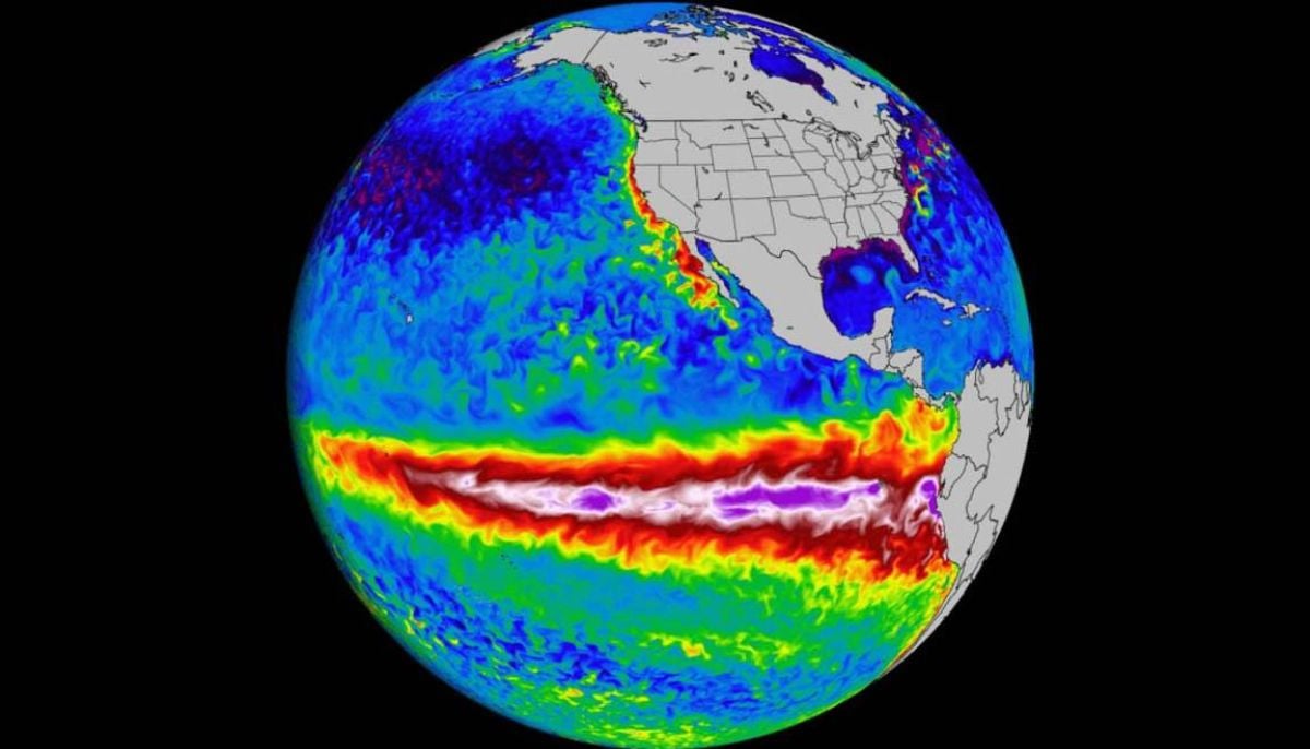
The world is set to witness the worst reality of climate change in the form of the strongest ever intensity of El Nino in 2026.
According to the updated forecasts from the National Oceanic and Atmospheric Administration (NOAA), it is highly possible to witness the odds of a “super El Nino” forming in the months ahead.
Multiple models and data from sources including the National Weather Service and European Union's climate monitor show sea surface temperatures in the Niño 3.4 region 3-4°C above normal, with over 90 percent probability of El Niño conditions through fall 2026 and winter 2027.
The European Union’s climate monitor said on Friday that ocean temperatures are edging toward record highs. “It’s a matter of days before we are back in record-breaking ocean SSTs (sea surface temperatures) again,” Samantha Burgess, strategic lead for climate at ECMWF, said.
As per the latest intensity prediction, there is a 60 percent chance of the phenomenon emerging by July with a growing 25 percent of it reaching record-breaking super levels in preceding months.
"Confidence is clearly shifting higher on potentially the biggest El Niño event since the 1870s," wrote Paul Roundy, a University of Albany professor and El Niño expert, in a post on X.
What is more scary is the experts’ warning: If the event of El Nino comes to reality and persists into 2027, it could worsen global temperatures, pushing them to record-breaking higher temperatures.
Certain factors are responsible for driving up the intensity of this year’s El Nino, including unusual “triple cyclones” in the West Pacific that are pushing warm waters eastward at a threatening speed driven by westerly wind bursts.
“These periods of strong winds blowing west to east are pushing warm waters onto the equator and driving them eastward, contributing to rapid warming in the eastern Pacific,” Roundy wrote.
“The next substantial westerly wind event will likely occur during the last 10 days of May,” he added.
Projections also suggest that it could rival historic events like 1982-83 and 1997-98. Scientists are closely watching the changes occurring in El Nino as any change is likely to spill into global weather disruptions including floods, droughts, storms, and food shortages.
Talking about the United States, in the wake of potentially intense El Nino, the states will witness unpredictable weather year. Western US States can face above-average heat and humidity and the southern ones will experience hotter and drier conditions.
El Niño is a natural climate pattern defined by unusually warm sea surface temperatures in the central and eastern Pacific Ocean.
This shift disrupts atmospheric circulation, triggering a domino effect that alters weather systems across the globe.

-
 China vs US tech rivalry escalates as Beijing accuses Washington of ‘AI hegemonism and distillation’
 -
 Iran holds firm on Strait of Hormuz as US strikes pause: ‘No change in position’
 -
 Nvidia forms industry-wide AI security alliance after Hugging Face hack
 -
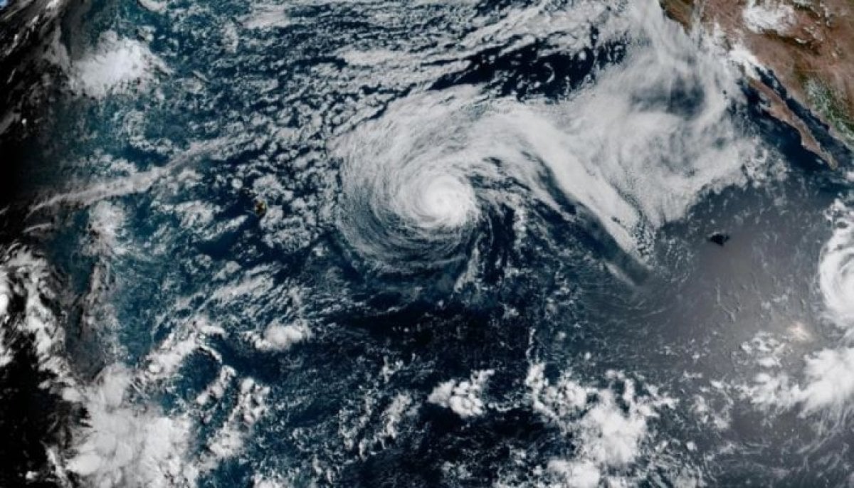 Genevieve becomes first Category 5 hurricane in East Pacific in two years
-
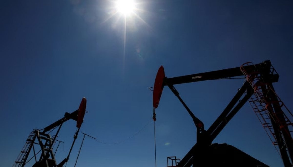 Oil prices post biggest drop since April as US and Iran pause fighting
 -
 New Joe Biden audio recordings reveal disagreements with Obama and memory lapses
 -
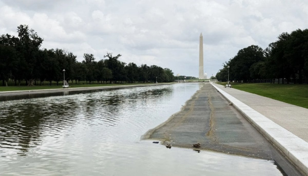 Grand jury witness says Reflecting Pool damage predated Davey Hearn case
 -
 US Consulate in Toronto targeted in shooting for second time this year
 -
 Paris Knife Attack: Man arrested after three women stabbed near Porte de Clichy
 -
 UN slams Venezuela's ICC withdrawal for undermining accountability
 -
 Kidnapping survivor Elizabeth Smart breaks silence on Nancy Guthrie’s abduction
 -
 Sam Altman and top senate democrat to hold high-stakes AI security talks


