Print Story
X

A traveller takes an unfamiliar route to a familiar destination and stumbles upon many a wonder that he would’ve otherwise missed
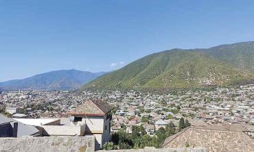
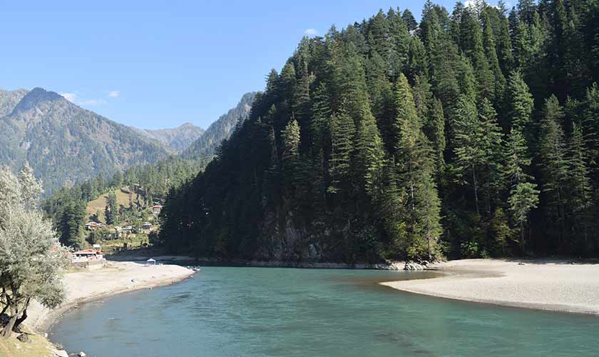
In October 2020, I found myself in the beautiful Aarang Kel, a town located at the far end of Neelum Valley, surrounded by some of the most beautiful mountains and a landscape turned gold at the beginning of autumn. We do not have the vision to promote autumn experienced in the Northern Areas of our country, like they do with the legendary fall in New York or Vermont, but hopefully we’ll get there at some point in future.
I am a big fan of taking different routes while approaching a familiar destination. In the past, I took the Dir to Lowari top route, Chitral to Shandur to Gilgit to KKH route and last year I took the Dir to Kumrat to Badawai top to Kalam route. This time around I intended to go to the Neelum Valley, stay at Aarang Kel for a while and then return via jeep from Shardah (6,500 feet) to Noori Naar top (13,000 feet) to Jhalkhad (in the Naran Valley – 10,500 feet) route. However, on our return from Arang Kel we were informed that the route we intended to take was closed post monsoon.
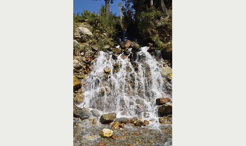
We started back from Kel at around 9 in the morning and reached Shardah at around 10:30 am. We were in no hurry and enjoyed the cool breeze, turquoise green waters of Neelum River, dense pines and occasional waterfalls along the way. Just before Shardah, we stopped at the intersection where a road branched up towards the Noori Naar top. We asked the soldier deputed at the Army check post close by if the route was open. The soldier gave a non-committal response and Google also failed to provide us with any substantive information about the route but we decided to soldier on. As we crossed the bridge over the crystal clear water stream coming down from the Noori Naar top and headed towards the Shardah town, we were still a little double minded over whether to go ahead or not. Yakub supported the adventure, Asad was non-committal and I was partially against it, however, after covering a distance of around hundred metres from the bridge, we agreed to go a few miles on the trek and see if we could find someone coming from the Naran end of the route to guide us on the trek conditions.
En route to the Noori Naar top, the first few miles were deceptive as the road was exceptionally smooth and carpeted black. As we saw a local jeep approaching from the other side, we waved at it to stop. The driver and the passengers gave us a cheerful thumbs up to cross over the Noori top into Naran valley. This was an encouraging sign, especially with the lovely road. Although we realised in a bit that it was not clear if the other jeep was coming from the Naran valley or some mountain village close by.
We passed by many villages on the continuous upward drive on the metalled road. There was zero presence of tourist jeeps on the route, which was alarming. But we thought it was due to the end of the tourist season. The signs of human habitation were dwindling and the road was slowly giving way to a shingle trek. We were now thirty minutes away from Shardah and as per Google Maps, we could reach Jhalkhad in about two hours. We decided to continue with the journey.
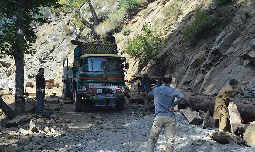
The trek was continuously winding upwards. On one of the turns, the road was blocked by some construction trucks. The workers signalled us to stop as they got the truck to a side. As the truck reversed, I could see it slipping over the gravel, but the driver seemed experienced. In a few minutes we were ready to resume the journey. As we moved ahead on the trek into a thick pine jungle, we found that the road was blocked again by a truck. This time it was the timber mafia loading wood logs in a truck parked in the middle of the trek. Our untimely appearance did not win us any favors. After a few minutes of ignoring us, the driver finally moved his truck to the mountain side of the trek, signalling us to cross from the cliff side. It was extremely difficult, but we crossed the blockade successfully and were again on our trek to the Noori top.
It took us about five hours to traverse the trek from Shardah in Kashmir to Jhalkhad in Naran valley. The trek can only be taken by high clearance SUV, there is no question of taking on that journey on a car. I would also suggest taking at least two vehicles as there is zero support system available on the way.
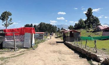
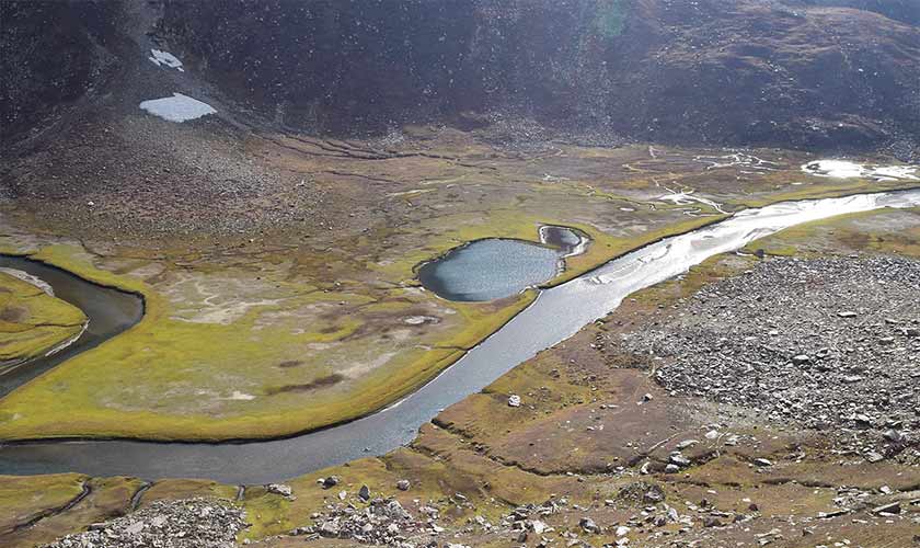
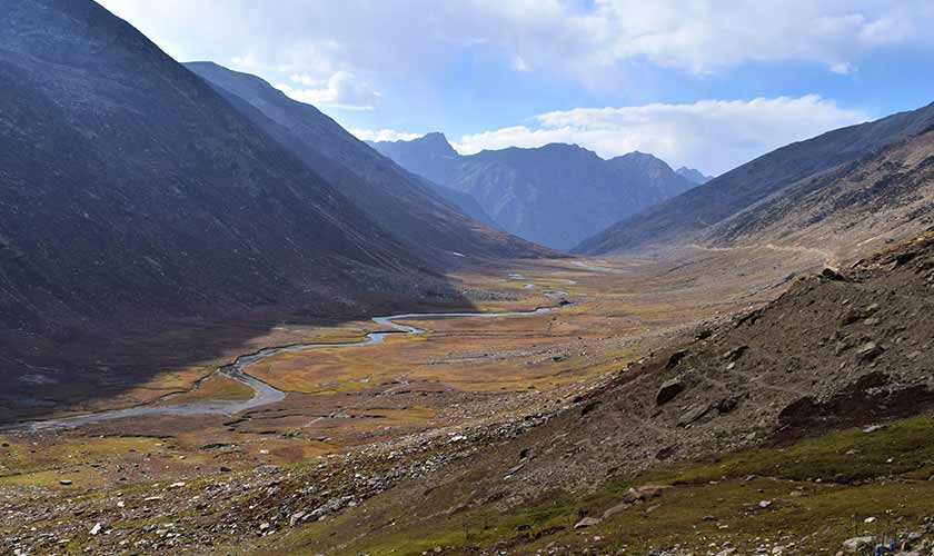
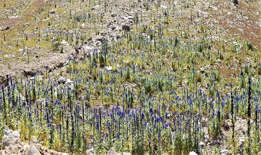
Till now, the trek mostly had the mountain on one side and thick pine wood on the other, with a stream flowing from Noori top deep in the gorge below. We could see small glaciers down in the gorge, at times completely covering the stream. Some time after an hour of our journey, we entered a grassy landscape similar to Shandur or the Babusar or Badawai top. As far as we could see, there were mountains covered with red and blue flowers and grass all around us and gave a lovely hue to the landscape.
We were slowly moving towards the Noori top and there were absolutely no signs of any human settlement around. The real challenge on such routes is crossing the mountain streams as water keeps changing the rock arrangements. One wrong rock impact on the engine and the jeep could be disabled. On our way, we came across a man cooking something using a solar panel by his side. He invited us in for tea, and on enquiring, told us that he was preparing a meal for the Gujjar shepherds on their way to the plains where they stay during the summers.
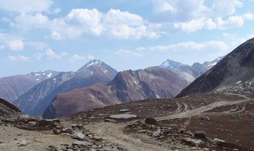
We stopped at a lot of interesting places to take pictures. For example, there was this beautiful natural zig zag design that we fell in love with, only to realise later that that was the actual trek we were going to be approaching in a few minutes. It was one of the steepest gradients of treks I had ever been to. However, the Frontier Works Organisation (FWO) has done a good job keeping the trek decently wide all along except where it is not possible to do so or where the trek has naturally narrowed over years. With every turn, the views of the surrounding mountains became even more breathtaking. In about three hours since our journey began from Shardah, with a few stops here and there, we were finally at the Noori Naar top. It was chilly there with strong winds. To our east was the Neelum valley while to our west was the Naran valley. Somewhere around us was the Noori Naar lake but to reach that needed a few hours of hiking and we did not have time or plans for that. After stopping by at the top for a few hours, it was time to descend towards Naran valley.
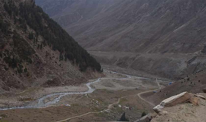
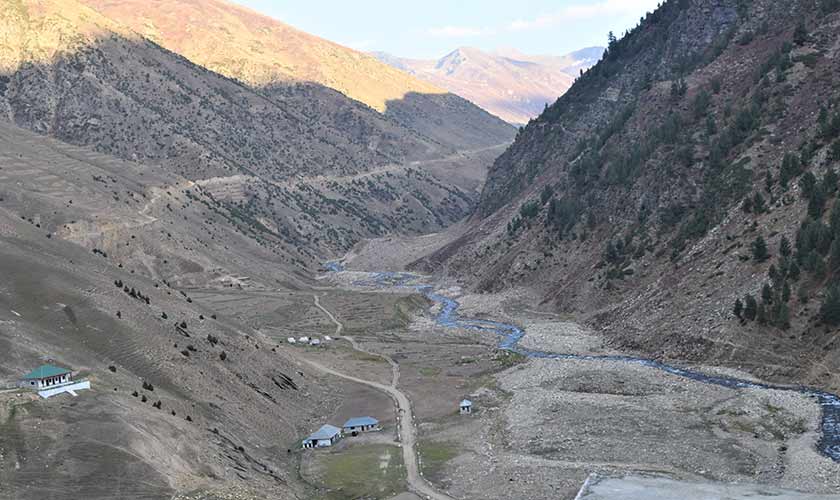
The landscape was much more beautiful on the Kashmir side of the Noori top with dense pines and golden hue bushes in the beginning of the trek, slowly giving way to mountains covered by maroon flowers. On the Naran side of the Noori top, we slowly descended with the Jhalkhad stream flowing at the bottom and miles and miles of lands on one side, where we could see occasional shepherd huts most of which were vacant as the shepherds had already moved on to the plains with the onset of winters. The trek was somewhat difficult to navigate, quite narrow at places. After travelling for about two hours, passing small mountain streams and enjoying a mesmerising landscape, we finally saw the Naran–Babusar road, much to our relief.
This was a lonely jeep trek and we did not find any human habitation in the four hours of our journey, except for a few vacant shepherd dens. We did not cross a single vehicle during most of our journey except for a couple of local bikers. It took us about five hours to traverse the trek from Shardah in Kashmir to Jhalkhad in Naran valley. The trek can only be taken by high clearance SUV, there is no question of taking on that journey on a car. I would also suggest taking at least two vehicles as there is no support system on the way.
We stopped at the FWO monument, built in memory for those who constructed this amazing route at the turn of the century as an alternative route to Neelum valley. There is reportedly another such trek currently not in use, which connects Taobut on western end of the Neelum valley with Astore in the Gilgit Baltistan. It would be wonderful if the government could develop and maintain both these treks as well as those like the Kumrat Kalam routes. Such development shall result in a lot of social and economic benefits for the local population, something the people of these areas have as much right to as any other citizen of Pakistan.
The writer is an international development professional with a passion for travel and heritage. He blogs at www.countryroads.pk and can be reached at omarmukhtar16@gmail.com.