Print Story
X

An unforgettable journey traversing the Hindu Kush, the Himalayas, and the Karakorum and all the treasures that lie in between
The quickest way to Skardu is to fly from Islamabad and land there in 30 minutes. The view over the mountains is spectacular but it deprives you of a more intimate interaction with the valleys and passes that adorn the northern areas of Pakistan. Or you could take the Karakorum Highway to Chilas and then turn right, to follow one of the most dangerous and dilapidated roads to Skardu.
If you are more interested in the journey than the destination, there is a much more complicated and roundabout option that will enable you to traverse three of the highest mountain ranges in the world -- the Hindu Kush, the Himalayas, and the Karakorum.
Starting from Islamabad by road and going via Chakdara to Lower and Upper Dir, you will reach the famous Lowari. If you are lucky enough to be there on a day when the perennially under-construction Lowari Tunnel is open for traffic, you may spare yourself the dozens of zigzags over the Lowari Top. But then what is point in taking that route if you are looking for shortcuts? So go for it, because sooner or later the tunnel will be complete and the joy of crossing the Lowari top will be lost forever.
A road journey from Islamabad to Chitral via Lowari Top may take 8 to 12 hours, depending on the weather and the volume of traffic. Once in Chitral, if you are not into camping, and looking for a decent lodging after the tiring journey; probably the best option is Hindu Kush Heights owned by the former ruling family of Chitral. The second best is Tirich Mir Inn that used to be a good hotel but, after the earthquake last year, has developed cracks that keep you awake even if a cat pounces by.
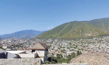
Chitral city itself is a small town located on the banks of the Chitral River which wreaks havoc whenever there are heavy rains in the mountains, and that has been happening quite frequently. From Chitral, usually one goes to see the Kalash culture with its exotic dresses and dances in Rumbur and Bumburet valleys. Meeting the Kalash people, you love their honesty and simplicity in receiving guests; their culture is threatened by the onslaught of increasing Sunni religiosity in the region. The ever-growing number of seminaries and zeal of the preachers is evident from changing ancient names of places to Islamic-sounding ones.
In addition to the Kalash, another place worth visiting in Chitral district is the Gol National Park, located in the Hindu Kush range bordering Afghanistan. Famous for its markhor goats, it was established in 1984 and offers a unique gorge spread over 20 kilometres. Though it is hardly a two-hour drive from Chitral city, the best time to visit is between May to September after which snow covers most areas and only an adventurous mountaineer can hope to climb them; moreover, the security agencies make it more difficult even in the summer season.
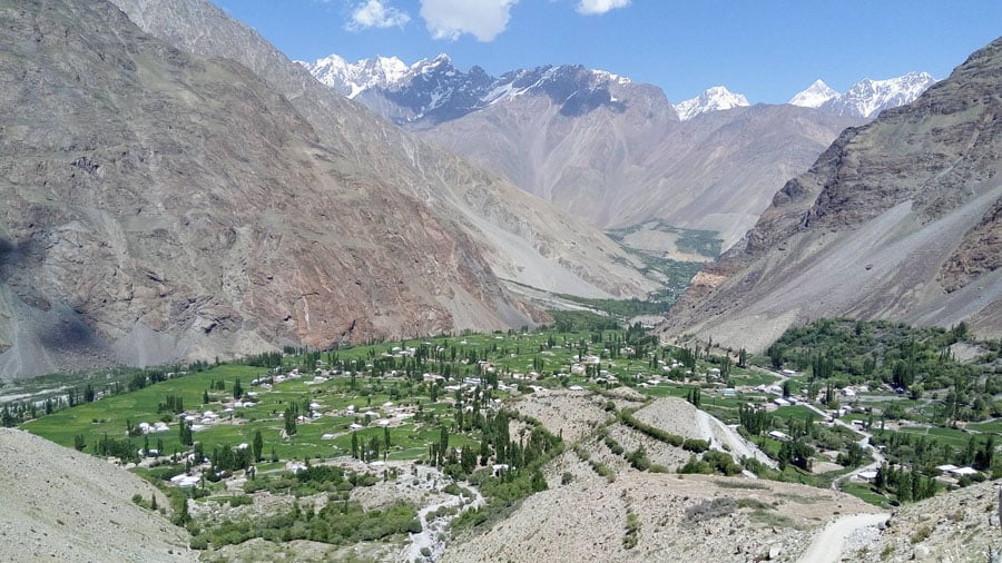
From Chitral, you go up north to Booni and Mastuj going through Reshun, a town that has been severely damaged by the devastating rains during the past couple of years. Booni has been without power for over a year now since its sole hydroelectric station was washed away by flash floods last year. The entire northern region of Chitral up to Shandur Pass presents the look of devastated villages and roads and the government of Khyber Pakhtunkhwa (KP) does not feel obliged to do anything about it. Talking to people there, you get a feeling of sadness and abandonment.
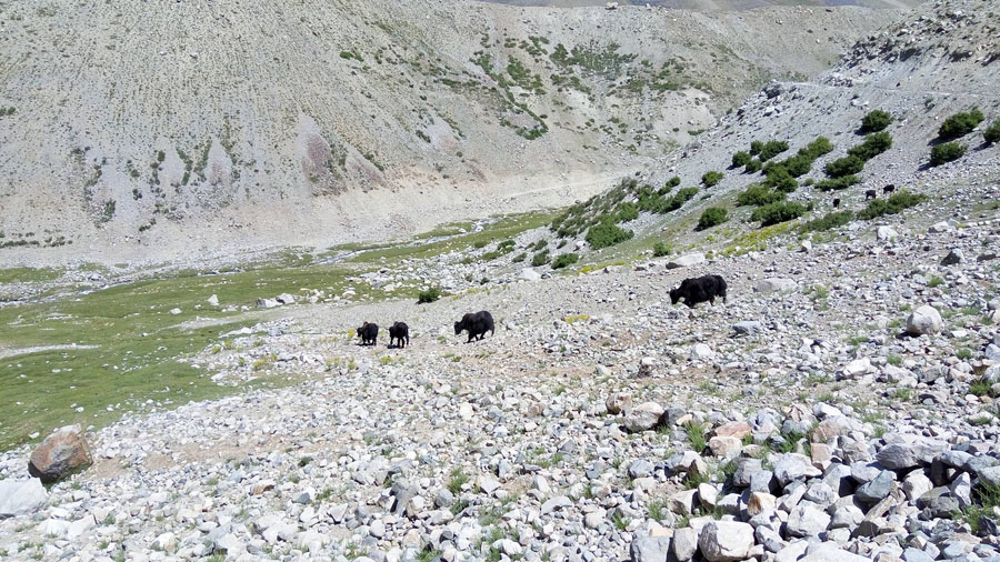
As one reaches the Shandur Pass, the first thing one notices is the yaks -- shaggy-haired bovine animals -- that roam around in dozens, grazing from the pastures and drinking from the running water that is ice cold and as pristine as nectar. As you cross the Shandur Pass at the altitude of around 3800 metres, you can see the highest polo ground in the world that touches the Shandur Lake also called the Roof of the World -- a title contested by many other high places. Shandur Lake is surrounded by mountains and is a disputed territory between the KP and Gilgit Baltistan (GB) governments.
Though Shandur is closer to Chitral (150km) than to Gilgit (200km), the local people feel more comfortable being part of GB, thanks mainly to the extraordinary development and welfare work being done by the Aga Khan Rural Support Programme (AKRSP). Similar work is also done in Chitral by the AKRSP but the capital of KP located in Peshawar poses more challenges.
As you move from Shandur you come across two more beautiful lakes full of trout in Khalti and Phandar. Just 50km from Shandur, in Ghizer district of GB, Phandar valley is one of the most beautiful valleys of the region.
Go another 50 kilometres or so and your eyes absorb another soothing view with Khalti Lake. Here you can stay in the PTDC hotel that offers various dishes of trout to your heart’s content. Move further towards Gilgit and you cross Gahkuch and Sherqila, finally landing in Gilgit, from where you can go up to Hunza valley and stay there overnight.
Next day, you could visit the Attabad Lake that was formed around five years back when a landslide blocked the river and a natural lake emerged surrounded by mountains. The lake brought boats as the only mode of transport between lower and upper Hunza valleys. Now with a series of tunnels built by the Chinese, boats are no more in use but the lake itself is a marvel of unexpected natural intervention.
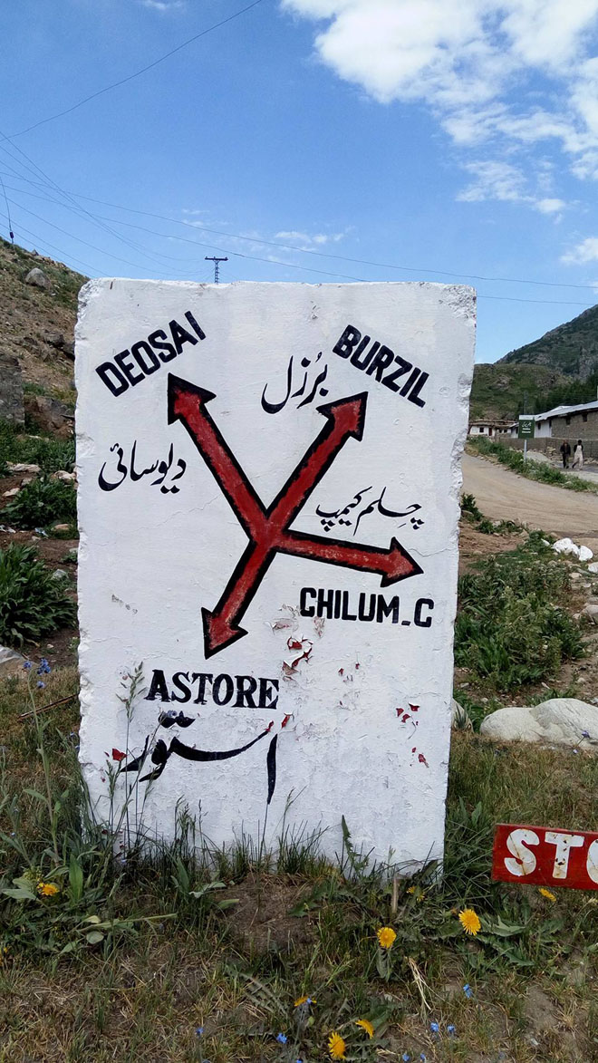
From Hunza, you may go straight to Sost Dry Port and up to the Khunjerab Pass bordering China, or you come back to Gilgit to go onwards to Skardu. To Skardu there are two possible approaches: one through Roundu, and the other via Astore and Chilum Chowki to Deosai National Park which leads you to Satpara Lake bordering Skardu. Deosai National Park is located among Astore valley, Gultari, and Kharmang but most of it falls within the Skardu district.
Deosai -- loosely translated as the land of giants -- is only accessible in summer. If you thought the Shandur Pass was rightly called the roof of the world, you should have waited for the Deosai, as its elevation at 4150m is 350m higher than Shandur. So if any place can be called the roof of the world, it should be Deosai, though Chang Thang plateau in Tibet is also a contender.
Travelling through hundreds of kilometres of Deosai, you feel as if the mountain summits in the distance are at your chest level.
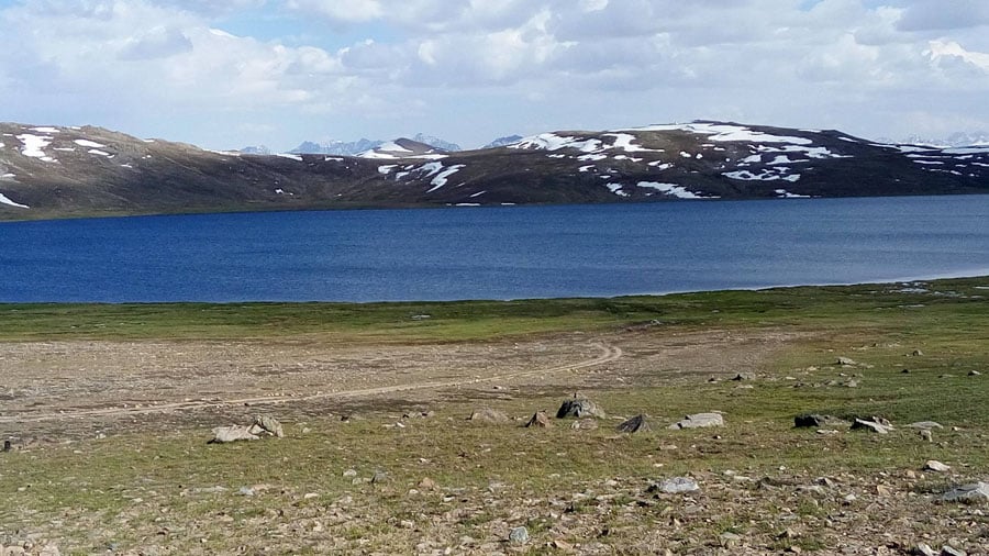
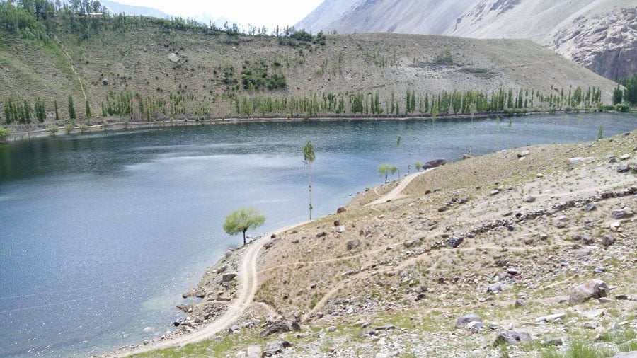
Since Deosai Park protects an area of around 3,000 sq km, on your journey to Skardu you can only pass through a small portion of the Deosai Plains. Unless you want to set up a tent, you can’t stay anywhere since any type of construction is strictly prohibited, and rightly so. The most amazing sight that you behold is the Sheosar Lake which is one of the highest lakes in the world -- even higher than the Shandur Lake. When you exit the park, you are just 30 kilometres away from Skardu and on the way you can have tea at the Satpara Lake, of course if the security personnel posted there allow you.
Reaching Skardu opens your way to Shigar and Khaplu valleys. If you have at least two weeks in hand, the adventure from Chitral to Skardu via Deosai is definitely worth a try; you bet it will be once-in-a-life-time experience.