Print Story
X

Glaciers in Khyber Pakhtunkhwa and Northern Areas pose serious threats to local and downstream populations
| T |
he effects of climate change have started manifesting with glaciers in Khyber Pakhtunkhwa and Northern Areas becoming a constant threat to the local population and the downstream districts.
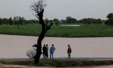
The Chitral administration has recently issued a flood warning advising people living along the embankment of Yar Khoon River to be prepared for possible evacuation as glacial water has accumulated at the Pasoon Gol Mastooj area of Upper Chitral. “The people have been informed that Yar Khoon River has turned into a large lake following glacial lake outburst floods (GLOF) in Pasoon Gol Mastooj area. This has raised the risk of flooding in lower areas of the district,” a statement issued by deputy commissioner says.
The district administration of Chitral has informed the community about the latest developments to ensure that adequate safety measures can be taken. People living on the embankment of Yar Khoon River have been advised to move to safer places for the time being.
Outside the polar regions, Pakistan is one of the world’s major centres of glacial ice. Over 7,000 known glaciers lie within its borders. More than 500 of these glaciers are in the remote Chitral valley. The entire area is at risk of the GLOFs.
On June 28, a flood in the Reshun nullah caused road links to rest of the Chitral to be severed. Due to the melting of glaciers and hill torrents in many places, several ravines in Upper and Lower Chitral were flooded. At Yar Khoon, Harchin Laspor, Arkari and Lohkot, link roads and connecting bridges were damaged. Due to the collapse of the Mastuj bridge, Upper Chitral was cut off from other areas. In many places, tourists seeking to return home following the culmination of the Shandur Festival were stranded for hours. The locals helped with arrangements for the safe passage of these tourists. According to locals, floods in Yar Khoon forced dozens of families to evacuate. Recently a shortage of safe drinking water following the floods has led to an outbreak of diseases in the area. The situation is similar to the 2015 flood.
Torrential rain and floods in Chitral had a direct impact on Upper Dir and Lower Dir as well. The Panjkora River and its tributaries have been in flood for several weeks. Many villages have been affected by the flood in the Chapar River. Though it started late, it has reached the high-flood level at Chakdara. The floods have damaged farm land, livestock and buildings in the surrounding villages. Many power stations have been temporarily shut down. Deforestation in Upper Dir and Lower Dir is being blamed for landslides that disrupted traffic for several hours.
Despite tall claims to the contrary by those in charge, reckless deforestation in Malakand division has led to an increase in landslides following moderate rains in these areas. This is especially true of the newly merged district of Bajaur, which shares a border with Afghanistan. The Afghan province of Kunar was once famous for its dense forests, which it shared with Bajaur on the Pakistani side. This year, like other forests in Khyber Pakhtunkhwa, there has been a record increase in forest fires in this region too. When the Pakistan Tehreek-i-Insaf (PTI) government launched its Billion Trees Tsunami Project, it was seen as an attempt to curb the devastating effects of climate change in these areas. Unfortunately, the project suffered setbacks due to rampant corruption. The timber mafia seems to have prospered at the cost of a large population.
The glaciers in Gilgit-Baltistan are also in grave danger. This region has many peaks above 7,000 metres and several rise above 8,000 metres. The peaks and valleys of Karakoram, the Himalayas and the Hindu Kush mountain ranges attract a large number of mountaineers and trekkers.
The major glaciers in Gilgit-Baltistan include the Baltoro, Chimmik, Godwin-Austen, Hainablak, Hispar, Kutiah, Miar, Panmah and Passu. The Gilgit River is a tributary of the Indus River. It starts from Shandur Lake and joins the Indus River near Juglot and Bunji villages. There is relatively little precipitation in Gilgit – ranging from 120 to 240 mm per year.
The Himalayan glaciers are threatened by climate change according to the Journal of Natural Science Advances, 2021. The main danger is that these melting glaciers will drain into large lakes leading to catastrophic flash floods. There are 3,000 glacial lakes in the region. Out of these 33 have been identified as perilous.
In Gilgit-Baltistan, the rise in average temperature and climate change have had a severe impact on the glaciers. Changes in the behaviour of Shashpur glacier have been documented recently. The melting of the glacier has accelerated the flow of water and damaged some low-lying areas near the Hassan Abad canal. Due to the rapid flow of water last month, the Hassan Abad Bridge on the Karakoram Highway was washed away. A medium-level flood was observed in the Hunza River, too. A pedestrian bridge built to cater to public needs and address transportation problems has been dismantled in view of the flood threat. Four houses close to Hassan Abad Canal have been destroyed by the recent floods. Some others too have been partially damaged.
The Hopper glacier in Nagar is also melting. Fortunately, it is far from any populated area. However, it can still be a threat to the people living in lower regions. Four women have already lost their lives in the district and several houses were washed away in the recent floods. Farm land and orchards have been damaged too. Apart from Hassan Abad valley, in Gilmat Gojal, Hopparnagar, Gohar Abad, Diamer, and Ghanche, floods and landslides have disrupted traffic and cut off communication.
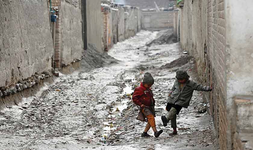
Rains and flash floods in the upper Khyber Pakhtunkhwa have also affected the Peshawar Valley. In Mardan, Swabi, Nowshera, Charsadda and Peshawar several residential settlements have been damaged and agricultural lands have been affected. So far, the Kabul River floods have not reached the 2009 levels. The floods and rains have caused panic in some rural areas. Rains and floods in the southern districts, from Kohat to Dera Ismail Khan, have caused severe financial and human losses. Landslides in North Waziristan have caused erosion due to hill torrent flooding in Afghanistan. Several villages of Tank district have been affected by continuous rains and flash floods. Besides human casualties, several government buildings have been damaged. These areas are constantly facing drinking water shortages.
Forest fires in Khyber Pakhtunkhwa started from the Koh-i-Suleman region. Later, similar incidents were also reported from other parts of the province.
Although climatic changes have taken decades to unfold, their effects are now intensifying by the year. There is a need for the imposition of an environmental emergency. In addition to public awareness campaigns, steps should be taken for the restoration of forests in these areas. This has to be a long-term and patient endeavour. Unfortunately, the government appears to be dragging its feet rather than taking an initiative in this direction.
The writer is a Peshawar-based journalist, researcher and trainer on terrorism, conflict and peace development. He can be reached at frkakakhel@gmail.com