Print Story
X

Map Book of the Punjab gives the general public a user-friendly access to the province’s spatial data
Non-availability and lack of easy access to relevant data have always been a major concern for researchers, academics, urban planners, policy makers, development sector professionals, donors, students and the like. Sometimes the data is there but is lying stashed in a corner in a government or private office with little or no access for those who can put it to good use.
On other occasions, the data is in such a complex form that it is not comprehensible for those trying to benefit from it.
Ideally speaking, the presentation of the available data should be such that the person accessing it will grasp the idea right away. Besides, the fact that quite often the data available to one is outdated or not collected through reliable modern tools creates credibility issues.
There are complaints too, that tonnes of data which should have been shared with the general public is kept hidden by the governments for no good reasons. This seems quite absurd at a time when the world is moving towards open governance and right to information, with the aim to bring in transparency and efficiency in systems.
Having said that, one is sure the importance of accurate data is phenomenal when it comes to tackling the issues of the day and planning for the future, especially in the public sphere. In the absence of details about the existing facilities and calculated future predictions, the planning in different fields can be skewed and create problems rather than solve them.
It can also be said that the exact identification of demand and supply gaps in different sectors such as health, education, public transport, water supply and sanitation, housing, agriculture, industry and employment, is dependent overwhelmingly on the availability and analyses of the related data.
No doubt, the governments in Pakistan have been using sets of data for policymaking and even budgeting but what has been generally missing is their proactive disclosure for the public. This, in a way, keeps out of the consultative process the people who may otherwise pre-empt misadventures and offer better suggestions and solutions.
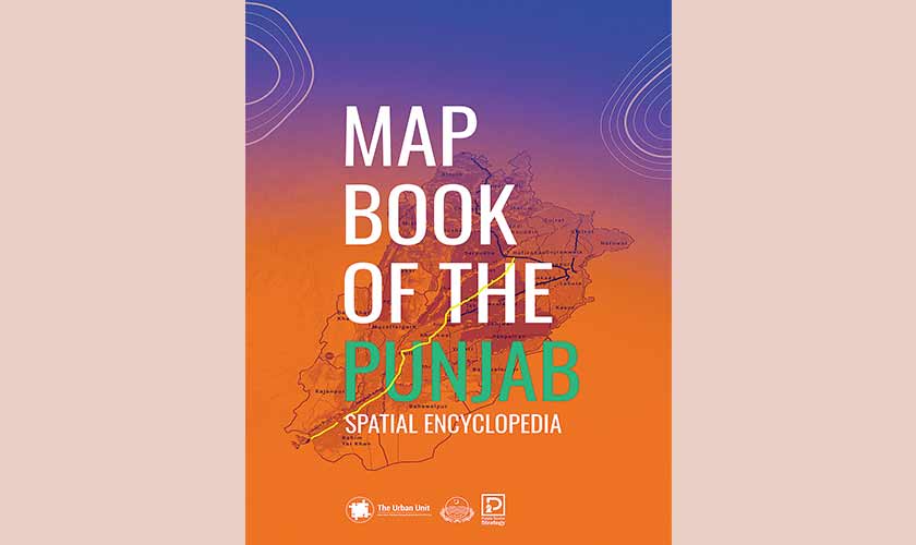
Of late, however, there has been a breakthrough in this regard, as one can access highly important information about Punjab through texts, pictures and, most importantly, maps, in the document, titled Map Book of the Punjab, which has been published by The Urban Unit (TUU), Government of Punjab, says Memoona Arslan, the editor of the document and the head of communications at the unit.
The book covers 13 themes including geography, settlements, education, health, transportation, industries, land cover and tourism, through self-explanatory maps, tables, statistics and texts. The data is presented in a way that the viewer immediately gets the idea about historical developments, existing opportunities and challenges, and the foundations to base future planning on.
The book covers 13 themes including geography, settlements, education, health, transportation, industries, land cover and tourism, through self-explanatory maps, tables, statistics and texts. The data is presented in a way that the viewer immediately gets the idea about historical developments, existing opportunities and challenges, and the foundations to base future planning on.
For instance, the table in the chapter on demographics ranks districts as per the annual population growth rate over a period from 1998 to 2017. Interestingly out of the 36 districts of the Punjab, Rajanpur boasts the highest annual population growth rate of 3.16 percent, followed by Lahore with 3 percent, Dera Ghazi Khan with 2.98 percent, Muzaffargarh with 2.63 percent, and Layyah with 2.59 percent. Such statistics tempt the researchers and planners to dive deeper into why the cities in South Punjab are experiencing a high population growth rate, and suggest means to cope with their needs related to housing, education, health and employment etc.
One also finds maps and tables that identify the locations of public and private health facilities across the province, educational institutions, the existing and possible public transport corridors, fertile agricultural lands, densely populated urban and rural settlements, and so on.
The chapter on environment has highly valuable maps of game reserves/protected areas in the province and the areas marked for having different concentrations of nitrates and total dissolved solids in drinking water, annual average temperatures, air quality and wind speed etc.
The map book, which will soon be available online as well, has been dedicated to late Khalid Sherdil, the former CEO of TUU, who lost his life in a plane crash last year. The team behind the document recalls the generous assistance it received from him through different stages of the project.
A message by Sherdil, carried in the opening pages of the book, goes: “Based on accurate data, maps and infographics that are thoroughly research based, advanced digital mapping technologies, satellite imagery, Android Apps, location data and of course Google Maps, Map Book of the Punjab is surely a reference many will rely on and refer to in the years to come.”
Mohammad Omar Masood, the TUU CEO, says the idea is “to present the GIS-spatial data on the Punjab in book form to facilitate the people who have equal claim to it.”
Masood, who has a PhD in urban planning from Massachusetts Institute of Technology (MIT), says that the maps used in the book “give planners and researchers food for thought, [as these] are highly comprehensible.” He cites example of maps about the available road networks in the Punjab that identify areas strong and weak in this context and pinpoint areas that need improvement.
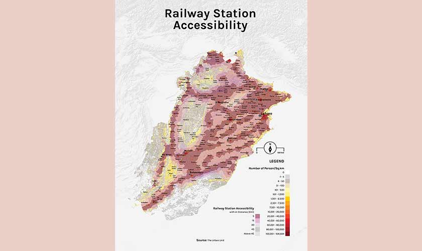
“While Railways is a federal subject, there’s a map on the existing and likely rail linkages that can make inter-city transportation swift and hassle-free.” A map in the book identifies inland waterways in the Punjab which can be used for transportation through rivers, though this mode is not in use yet.
The author is a staffer and can be reached at shahzada.irfan@gmail.com