Print Story
X

Rising seawater has claimed thousands of acres of fertile land along River Indus due to bad water management
Travelling on highway from Karachi to Thatta, the district which is situated at the tail-end of the majestic Indus, one could see sprawling lush green tracts producing cash crops a few years ago. But, in contrast, what one practically comes across now is thousands of acres of brackish land and the few green patches left around are fast turning into desert because of salinity.
The land owners, who once used to grow rice, sugarcane and wheat crops here, now haplessly watch those crops being replaced by wild growing thorny bushes.
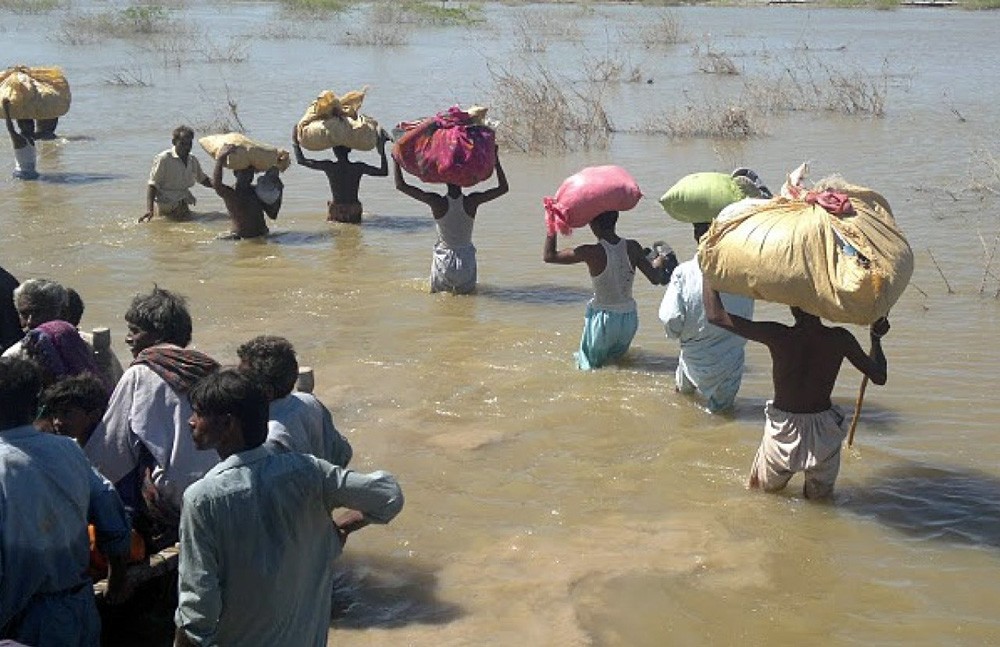
If you take a boat from Keti Bandar, once a busy port at the Arabian Sea and now an island surrounded by the sea, and sail through the delta where Indus falls into the sea, you will observe the seawater pushing the fresh river-water back. The seawater has already claimed dozens of islands where once our fishermen lived. But now they have deserted their villages in the face of the onslaught of seawater that has gobbled up many islands already. Those still battling the sea-rise complain about decreasing marine life -- thanks to the unavailability of fresh river water.
Gulab Shah is one of the many local farmers whose thousands of acres of lands have been swallowed by the rising sea level, a result of the climate change over the years.
He has already lost thousands of acres of land to the sea where he once cultivated cash crops of rice and wheat and is now trying to survive by relying on alternate crops such as banana, dates, coconut and vegetables sowed on small patches of land which still have some fertility left in it.
"Up to 35,000 acres of land in two districts of Thatha and Badin have been lost to the rising sea water level since 1999 when a major cyclone pushed the sea much beyond its original position," Shah said as he gave a tour of his lands, which are rapidly losing fertility.
"Our clan lost up to 12,000 acres to sea. My own family lost around 2,500 acres and now we are cultivating only 250 acres," he said.
"Even this land has been threatened by the rising sea level. Around 60,000 acres of the land is facing an urgent threat of extinction due to the creeping sea waters. If sufficient fresh water (river water) doesn’t arrive here, it will be lost to the sea in near future," Shah fears.
Pakistan’s coastline is 1,050 kilometres long (350 km in Sindh and 700 km in Balochistan) with a width ranging between 40-50 km.
The Irrigation Department and Board of Revenue Sindh estimate that the sea-water intrusion has resulted in degradation of about 1.22 million acres of land in Thatta and Badin. Six Talukas of district Thatta, Shah Bunder, Ketti Bunder, Ghorabari, Kharochaan, Mirpur Sakro and Jaati are the major victims of such a situation with the land loss of 50 to 70 per cent.
In total, 159 dehs of eight tehsils, spread over 1.22 million acres of land, have either been totally eroded or subsequently submerged by the sea. "That is why we pray for more and more floods because floods bring more water and helps push the sea water back. At the same time it brings silt which increases the fertility of our soil. Low floods which hit the upper parts of the country early this summer has left behind grass over the barren lands even though the quantity of water was insufficient. So floods are blessing for us and whenever flood waters come surging down in the Indus, we celebrate by going to the river and offering flowers to it, distributing sweets and playing Sufi music," Shah said.
According to a study conducted by Forest Geospatial Information and Survey Lab of Forestry University Putra, Malaysia, reduction in inflow of freshwater from Indus has resulted in loss of habitat and biodiversity, decline in fish productivity and also the mangroves which occupy approximately 600,000 hectors of Pakistan’s coastal areas.
The study estimates total water available from the Indus catchments is 150 Million Acre Feet (MAF). Over the period of past sixty years, the quantity of sweet water flow has been reduced to about 35 MAF which mainly occur during 3 months (monsoon season).
The data of discharges below Kotri barrage over the years from 1940-41 to 2000-01 shows that the total annual discharge below Kotri has been variable, but surely indicates a gradual decreasing trend. The average flows released below Kotri has been reduced to 34.8 MAF
This reduction in the downstream water flow has been due to changes in land use, expansion of agriculture, intensive cropping, building of dams for irrigation and power generation, industrial growth, and increase in population upcountry. The situation has further aggravated because of low rainfalls, especially in the catchment areas during the recent years which has created extreme water shortage in the River Indus.
Annual average net water availability during the period 1922-2003 in 4 out of 5 years is estimated to be 116 MAF. Present annual water commitments add up to 146.9 MAF. That leaves a deficit of 30.9 MAF. This has created a huge water shortage problem in the lower Indus basin, resulting in significant impacts including decrease in the flow of fine nutrient-rich soil brought by the river during its course through the fertile plains from 400 million to just 100 million tons per year.
Mustafa Gurgaze, a water expert who is working in the area, says that scarcity of water in the region and climate changes has complicated this issue. "The water flow in the river has decreased to an alarming level. But the available water is also being misused," he said.
"The governments and people have themselves violated the rivers and constructed too many dams, polluted the river and encroached on it by constructing houses and factories in the river-bed. We can improve this situation by letting the river flow freely and by not wasting the water upcountry," he suggests.
Grow, an international campaign to improve food security, has involved the locals to adopt new methods of agriculture in the fight against climate change and build pressure on governments to better arrange the river. The community is actively participating in the change and awareness activities, but Gulab Shah is not very hopeful.
"The whole water management system needs to be changed. Our demand for supply of water at the tail is 35 MAF. Even if there is a disastrous situation still we need 10 MAF at the least at tail to fight and keep the sea water back and protect our lands. The distribution of water needs urgent improvement," he said.