Print Story
X

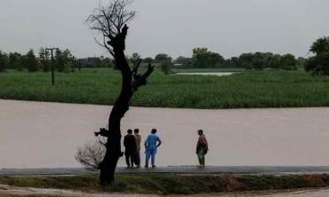
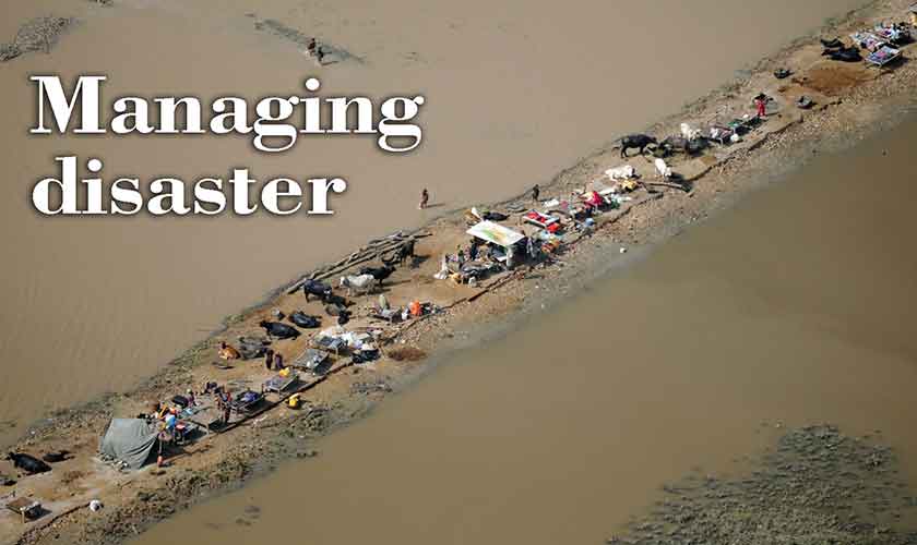
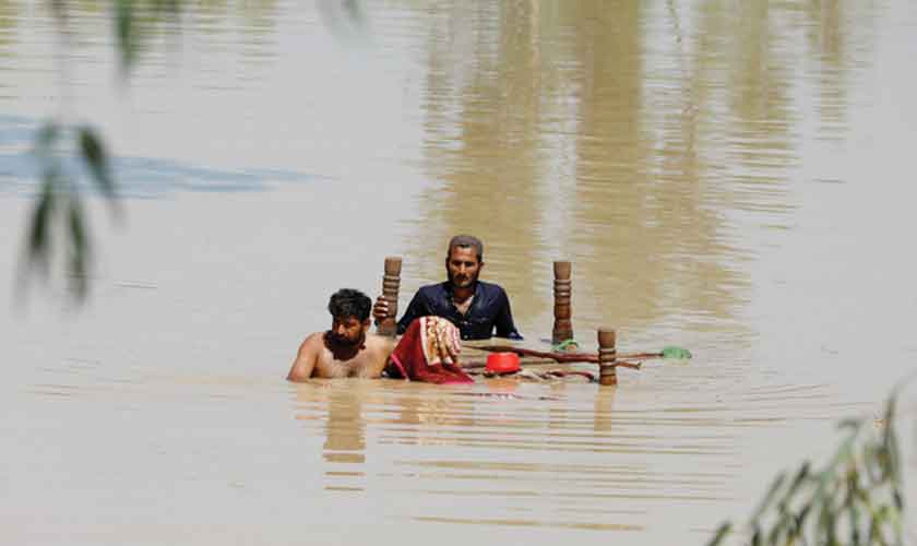
The adverse consequences of last years’ flood continue to impact a significant number of people
| L |
ast week, a year after the devastating floods that hit the country, the United Nations Satellite Centre (UNOSAT) released its preliminary assessment report. The report states that between June 16 and June 20, around “three million people lived close to the maximum floodwater areas and 468,000 people lived close to the minimum flood water areas.” It compared the satellite observations between the periods: April 26 to April 30, and June 16 to June 20. It found that an “increase of approximately 2,000 square kilometres in Sindh and 3,500 square kilometres in the Punjab in the water extent.”
The adverse socio-economic and ecological consequences of last years’ flood continue for a significantly large number of people. Now we are heading towards another rainy season.
The struggling economy has only added to the woes and rendered the recovery more difficult. The Post Disaster Needs Assessment prepared by the United Nations Development Programme, the World Bank, the Asian Development Bank, and the European Union for the Government of Pakistan, estimated the flood damages at around $30 billion and calculated the reconstruction cost to be over $16 billion. Last year at COP 27, Pakistan’s devastating floods were presented as a case to advocate for the “loss and damage” fund. Following this, Pakistan was promised only $10.57 billion by multilateral and bilateral creditors for reconstruction at the International Conference for Climate Resilient Pakistan in Geneva. Amidst our financial and institutional limitations, we cannot afford another catastrophe.
When last year’s devastating deluge struck, we weren’t prepared. The National Monsoon Contingency Plan 2022 by the National Disaster Management Authority (NDMA) acknowledges that we do not have effective telemetry systems and modern weather forecast radars for early prediction of floods. At its earliest, the seasonal weather forecast can be made for 7 to 15 days with an accuracy rate of around 65 to 70 percent. In case of our eastern rivers, we still rely on data from India. It says there is “non-availability of telemetry data/ early warning system for flash floods in hill torrents of south Punjab, Khyber Pakhtunkhwa, Balochistan, Azad Jammu and Kashmir and Gilgit-Baltistan which impacts on early warning/ response time for communities”.
Pakistan is among the most climate change vulnerable countries. Unfortunately, extreme weather events like urban flooding and flash flooding are going to be frequent in the wake of global warming.
Monsoon rains are upon us. Are we prepared this time?
Two weeks ago, the NDMA held a Monsoon Coordination Conference with key stakeholders to “foster coordination and review monsoon preparedness”. Its latest Remodeled National Disaster Mitigation Plan II, points out that institutional capacities for effective disaster risk reduction (DRR) at district level are inadequate. It also highlights a lack of coordination between various responding agencies at the federal and provincial levels and “limited early warning systems in main areas of concern”. The plan claims that there is “advance level end-to-end early warning system for floods and other natural disasters in place in Pakistan” but relaying messages in remote areas of the country remains a daunting task. The report does not share the details of the “advanced level end-to-end early warning system.”
There is ample evidence to suggest that we have been unable to modernise our early warning systems for the areas that need them the most. Glaciated regions are one example of this.
In its Seasonal Summer Outlook 2023, the NDMA states “timely issuance of qualitative weather forecasts/ alerts by the Pakistan Meteorological Department will be essential to ensure effective early warning to at-risk/ affected areas”. In case of glacial lake outburst floods (GLOF), it asks the individuals and communities to keep updated on weather forecasts and warnings from the PMD/ the NDMA and other disaster management agencies. Its organisational approach envisages monitoring water levels, weather conditions and movement of glaciers. The report also asks for installing “early warning systems for both avalanches and landslides in areas with high risk.”
There is ample evidence to suggest that we have been unable to modernise our early warning systems for the areas that need them the most. The glaciated regions are one example of this. Pakistan has more than 7,000 glaciers and more than 3,000 glacial lakes. Very few glaciers are being monitored regularly. According to Dr Adnan Siddique, co-founder of the Remote Sensing and Spatial Analytics Lab at the Information Technology University, and co-researcher of AI4GLOF project, spaceborne remote sensing technologies have made it possible to monitor the glacial lakes and provide risk assessment in advance of potential GLOF events. Advances in machine learning and AI methods supplement remote sensing and allow development of highly accurate flood models. Together with ground data, we can set up robust early warning systems. He adds that for some years now, national level reports have been stressing the “dire need” to carry out detailed multi-hazard vulnerability risk assessment (MHVRA) at district level, and identify the vulnerable populations but not much has been done so far. Researchers in his lab have recently conducted an analysis of infrastructural vulnerabilities in selected flood-prone areas of Pakistan. Provision of critical insights like these can be scaled up to mitigate the effects of hazards like GLOFs, and flash floods on the most vulnerable communities and their livelihoods. Early action informed by effective early warning systems can prevent extreme weather events from becoming disasters and catastrophes.
Pakistan needs to immediately modernise its early warning systems. We need to adopt a systems approach to build and strengthen our early-warning, early-action systems. Historical data from sources like satellites, radars and rain gauges must be used to predict and detect heavy rainfalls and flash floods. The meteorological and topographic and hydrological parameters vary in the regions creating different types of floods. There is a need to develop, evaluate and train regional forecasting models for the vulnerable areas for effective forecasting. The government can crowdsource and collaborate with experts for simulating local models. This will not only improve the quality of early warning systems but also help to innovate effective disaster risk reduction and build people-centred early warning systems at local level. This will build trust and ensure accountable environmental governance.
Sendai Framework for Disaster Risk Reduction aptly states “disaster risk reduction requires an all of society engagement and partnership. It also requires empowerment and inclusive, accessible and non-discriminatory participation, paying special attention to people disproportionally affected by the disasters, especially the poorest.” Our government needs to tap into the collective wisdom of the citizens of this country; it also needs to recognise that top-down approaches will never help address our climate concerns.
The writer is a teaching fellow at the Department of Governance and Global Studies, ITU, Lahore. She can be reached at @malyhaz